ALERT For Accumulating Snow Tonight – Beginning As Mix Below 2700 feet ( All Snow Above 2700 feet ) With A Fast Moving Clipper System
Steep creeks draining the High Knob Massif have had strong rises during today, so caution is advised when around these creeks. The run-off has begun to slow as air temperatures dropped back below freezing at higher elevations into the predawn-morning.
Overnight Into This Morning
Rain. Heavy at times. Rain changing to snow by the predawn ( especially along and west-northwest of the Cumberland Mountains ). S-SSE winds 10-20 mph, with higher gusts, below 2700 ft. SSE-SSW winds increasing to 15-25 mph, with higher gusts, on upper elevation mountain ridges. Predawn winds shifting WNW-NW at 10-20 mph, with higher gusts. Temperatures dropping during the predawn-morning back into the 20s to lower 30s. Wind chills in the 10s and 20s along mid-upper elevation mountain ridges ( coldest at highest elevations ).
A period of moderate-heavy snow remains possible, especially in upper elevations where moderate snow has recently been falling on High Knob ( since 3:00 AM ), but trends have been for the most signficant snow band to remain just west and northwest of the Virginia-Kentucky stateline ( northwest of Pine Mountain ).
This Morning Through This Afternoon
Any early snow giving way to flurries, then mostly cloudy skies. Winds becoming variable & light ( generally less than 10 mph ). Temperatures varying from the upper 20s to the upper 30s ( coldest at highest elevations ). Milder in lower elevations toward the Tri-Cities.
Tonight Into Wednesday Morning
Cloudy with snow developing. A possible mix in lower elevations ( below 2700 feet ) at the beginning. A period of moderate to heavy snow possible. Winds NW-N 5-10 mph, with higher gusts, along mid-upper elevation mountain ridges. Temperatures dropping into the 20s to lower 30s. Wind chills in the 10s & 20s on exposed mountain ridges.
Snowfall Forecast – Tonight Into Wednesday AM
General 1″ or less north of a Cumberland to Wise Line
1″ to 2″ below 3000 feet in Norton-Wise area
2″ to 3″+ above 3000 feet in High Knob Massif
Target Snowfall of 1.2″ in Norton-Wise ( +/- ) 0.5″ . This implies potential for 0.7″ to 1.7″ of snowfall. In general, lesser amounts of 1″ or less will be toward Pound-Clintwood with heavier amounts to the south toward the High Knob Massif. The centroid of the clipper is tracking to the south, with heaviest amounts likely along the TN and NC border area from the Smokies northeast. Any south shift in the current forecast track could bring the 1″ or less line farther south into Wise County. Although this is expected to be a light event, a period of moderate-heavy snow remains possible and sticking on roadways ( especially with freezing of any initial mixture or drizzle ) will become most likely later tonight.
Weather Discussion ( February 16 )
I have cleaned up the forecast page this afternoon for the next clipper system that races through tonight. Snow has been falling atop the High Knob Massif since about 3 PM.
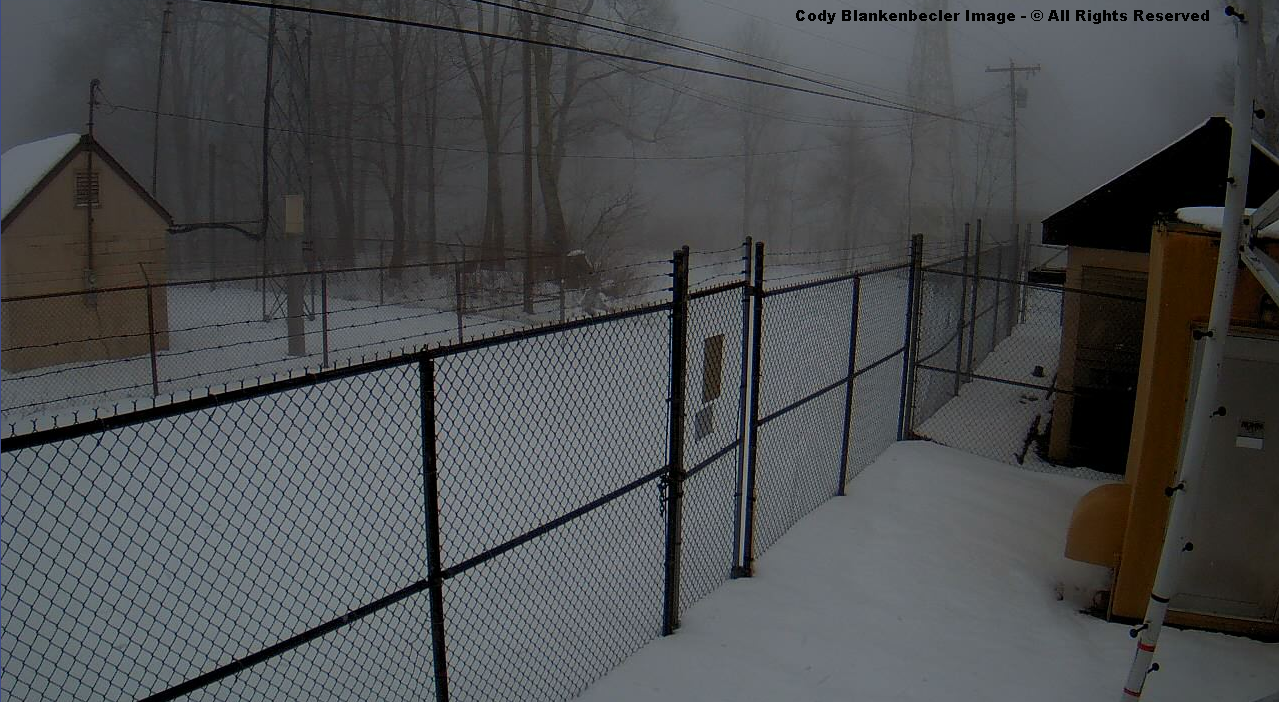
High Knob Massif Webcam – University Of Virginia’s College At Wise
Orographic clouds have obscured the High Knob Massif during late afternoon, with light snow falling. What falls will be all snow at elevations above 2500 to 3000 feet, with a center point of 2700 feet for the initial rain-snow line. A mix will be possible below this elevation until evaporative cooling allows for mostly snow at all elevations along and north of the High Knob Massif.
*Lower elevations south of the High Knob Massif in the Clinch, Powell, and Holston river valleys may be a little slower to see transition to all snow.
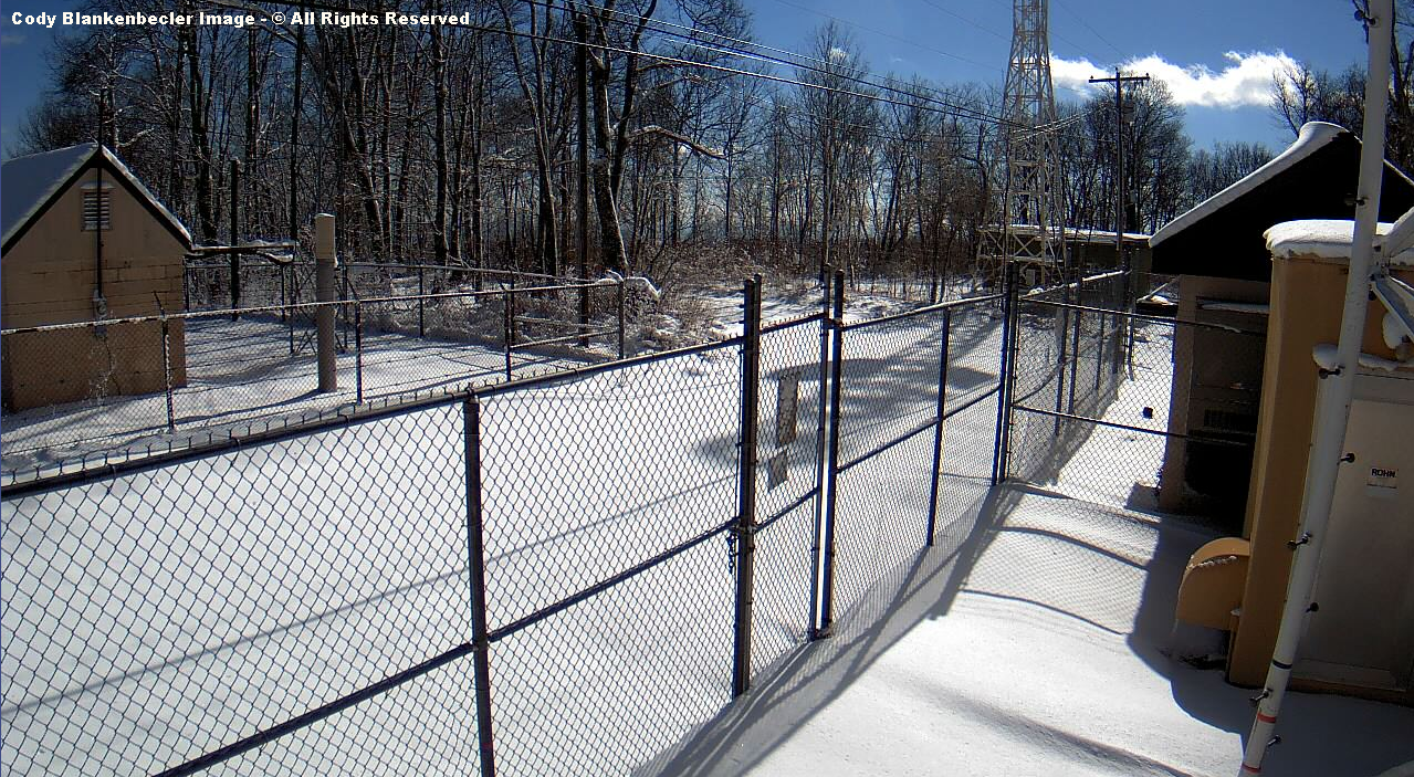
High Knob Massif Webcam – University Of Virginia’s College At Wise
Roads remain covered and snow depths more than 6″ in the crest zone of the High Knob Massif this afternoon, but a big snow depth decrease of up to 8″ or so occurred with 2.00″+ of total precipitation during the past 24+ hours.
Eagle Knob of High Knob Massif at 4:25 PM – Tuesday ( February 16, 2016 )
Steep creeks draining the high country began to respond by this morning, with strong rises, but also with a delay as the snowpack did act to absorb and release water more slowly.
Big Stony Creek Stream Levels – Up To 8:15 AM Tuesday ( Feb 16 )
ALERT For Heavy Rain Changing To Wet Snow By The Predawn-Morning Hours Of Today – Remain Alert For Water Ponding Along Roads, Snow Clogged Drains And In Low-Lying Poor Drainage Locations.
Caution For Black Ice and Snow On Roadways As Temps Drop Back To Around And Below Freezing
Updated Risk Regions For A Change From Rain To Period Of Snow
The highest risk region on the above graphic is along and northwest of the BLUE Line, which I have along Pine Mountain, with a high-moderate risk for locations along and northwest of the RED Line for at least a period of rain to wet snow.
A change from rain to wet snow is expected during the period between 1:00 AM and 4:00 AM, with changes first toward the southwest and at highest elevations rapidly overspreading the Cumberland Mountains.
Reference my 021516 Forecast and Discussion for more details.
HRRR Model Snowfall Forecast Next 15-Hours
Highest resolution models available are giving out a signal that fits the climatology of past such cases. So I have posted the region where a risk of heavy wet snow will be greatest above. THIS DOES NOT MEAN IT WILL OCCUR in a manner that is disruptive, but gives everyone an advance warning that it will be possible ( the risk for a change to heavy snow is high, with accumulations for any given place being the main unknown factor ).
The general trend is for heaviest snow amounts to the west and northwest, with lesser amounts toward the south and southeast, with respect to the Cumberland Mountains ( e.g., eastern Kentucky has a higher chance for more significant accumulations than does most of northeastern Tennessee, as illustrated by the models ).
NAM 4 KM Model Total Snowfall Forecast – Next 12-Hours
When the 32 degree air moves back overhead there will be little lag time before it can begin to accumulate at lower elevations on the Virginia side of the stateline. In between, a milder zone in the middle elevations ( like at Wise ) will have to be overcome ( air is colder both below and above the elevation of Wise tonight ).
The temp at 1:00 AM is holding steady at 32 degrees in Clintwood, with a borderline rain-freezing rain event.
GFS Model Total Snowfall Forecast – Next 12-Hours
Overnight Into This Morning
Rain. Heavy at times. Rain changing to snow by the predawn ( especially along and west-northwest of the Cumberland Mountains ). S-SSE winds 10-20 mph, with higher gusts, below 2700 ft. SSE-SSW winds increasing to 15-25 mph, with higher gusts, on upper elevation mountain ridges. Predawn winds shifting WNW-NW at 10-20 mph, with higher gusts. Temperatures dropping during the predawn-morning back into the 20s to lower 30s. Wind chills in the 10s and 20s along mid-upper elevation mountain ridges ( coldest at highest elevations ).
A period of moderate-heavy snow remains possible, especially in upper elevations where moderate snow has recently been falling on High Knob ( since 3:00 AM ), but trends have been for the most signficant snow band to remain just west and northwest of the Virginia-Kentucky stateline ( northwest of Pine Mountain ).
This Morning Through This Afternoon
Any early snow giving way to flurries, then mostly cloudy skies. Winds becoming variable & light ( generally less than 10 mph ). Temperatures varying from the upper 20s to the upper 30s ( coldest at highest elevations ). Milder in lower elevations toward the Tri-Cities.
Tonight Into Wednesday Morning
Cloudy with snow showers developing. A period of moderate to heavy snow possible. Winds NW-N 5-10 mph, with higher gusts, along mid-upper elevation mountain ridges. Temperatures dropping into the 20s to lower 30s. Wind chills in the 10s & 20s along exposed mountain ridges.
A new disturbance will renew snow showers tonight, with light to perhaps moderate accumulations ( in favored upslope locations ) expected into Wednesday morning, especially for locations along and north of the High Knob Massif and Tennessee Valley Divide.
Weather Discussion ( February 15-16 )
I heard a friend of mine call this the Valentine’s Slop Storm, and that is likely as good of name as any for what has been a royal pain to deal with both underfoot and forecasting.
As of 2:00 AM, trends continued toward a change to wet snow but with the most significant accumulations more likely along and west to northwest of Pine Mountain, so that is where I have placed the highest risk for up to 4″ or more of snow. It will be interesting to see how it plays out.
Sandlick Elementary School in Birchleaf – Up To 2 AM on February 16, 2016
This has been a border-line freezing rain event throughout the mountain hollows of Dickenson County, and colder hollows in Wise County, with official temperatures in Clintwood holding steady at 32 degrees ( around 33 degrees in Birchleaf ).
Lonesome Pine Airport In Wise Up To 1:55 AM Tuesday ( February 16 )
Go up more than 1,000 vertical feet higher in elevation and temperatures have been in the 40s, even with the 2 degree or so warm bias at Lonesome Pine Airport, readings have been around 10 degrees or more warmer than adjacent mountain hollows.
Black Mountain MesoNET Up To 2:15 AM Tuesday ( February 16, 2016 )
Continue upward 1347 vertical feet above Wise and temperatures on Black Mountain have now dropped below freezing again after holding steady in the upper 30s for a good while.
Up on the High Knob Massif an initial transition from rain to freezing rain had turned to snow around 3:00 AM with a temperature of 29 degrees ( moderate to heavy snow was falling by 3:30 AM ).
Big Stony Creek – February Stream Level Graph To 2:15 AM on Tuesday
Well over 2.00″ of total precipitation had fallen, as of 2:15 AM on Tuesday, at Big Cherry Lake Dam but had not yet ( at least ) generated a strong rise on adjacent Big Stony Creek. This indicated that the deep snowpack has been absorbing and holding much of the rainfall ( with major shrinkage of the snow depth within orographic clouds and rainfall ).
Another round of snow develops tonight into early Wednesday with a clipper-like system.
A Major Winter Storm Will Impact The Mountain Area With Multiple Threats Through Today Into Tuesday. A Second Disturbance Will Then Renew The Chance For Significant Snow Late Tuesday Into Tuesday Night.
Let’s Try To Lay Out What Is Upcoming In Headlines:
Bands of moderate to heavy snow will give way to mixed precipitation into Monday AM to mid-day.
*Timing on the change from snow to mix-rain varies from the predawn to between sunrise and early afternoon. This will be important to snow amounts, as a new wave of moisture over western-middle Tennessee & Kentucky moves into the area.
A change to all rain will become possible, with the potential for moderate-heavy rainfall by later today.
*The potential for freezing rain will exist in any locations that remain below freezing ( of course ), and could even occur on surfaces which are very cold from 5+ days of sub-freezing conditions where air temperatures go above freezing.
*Other concerns that will need to be monitored include rainfall amounts and absorption by snow on roof-tops where significant weight could be added into tonight and Tuesday. In addition, if rainfall becomes heavy, run-off issues could arise and this will need to be closely followed later today into tonight for poor drainage locations, roadways, and for rises on streams.
A change back to snow, especially at middle to upper elevations above 2000 feet, will become possible by Tuesday Morning. A period of heavy, wet snow will be possible during the morning, with greatest amounts expected at the highest elevations ( more than 3″ ).
*A surface low pressure will be intensifying along the eastern side of the Appalachians late tonight into Tuesday morning. Models are not yet together on exactly how this plays out, but potential for a change to heavy, wet snow must be respected…especially from the Cumberland Mountains westward and northeastward.
It should be noted that the NAM Model is showing the type of development that is climatologically favorable for heavy snow in the Cumberland Mountains. This has to be updated and followed very closely on new runs in coming hours.
A second system dropping into the mountain region will renew a threat for significant snow late Tuesday into Wednesday.
*If the above were not already enough, a second clipper system is forecast by models to race southeast into the base of this eastern USA upper air trough to renew the threat for a period of moderate to heavy snow late Tuesday into Tuesday night-Wednesday.
Overnight Into This Morning
Snow & blowing snow. Heavy at times. Possibly becoming mixed with sleet or freezing rain. SSE winds 5-15 mph, with higher gusts, on mid elevation mountain ridges-plateaus. SSW-SW winds 15-25 mph, with higher gusts, along upper elevation mountain ridges. Temps rising and becoming widespread in the 20s. Wind chills in the 10s & 20s on exposed mid-upper elevation ridges & plateaus ( single digits in gusts along mid-upper elevation ridges ).
This Morning Through This Afternoon
Snow changing to rain ( possibly freezing in some places and upon very cold surfaces ). SSE winds 5-15 mph, with higher gusts, on mid elevation mountain ridges-plateaus. SSW-SW winds 15-25 mph, with higher gusts, along upper elevation mountain ridges. Temperatures struggling to rise above freezing, especially over snow in valleys & along the highest windward ridges in the High Knob Massif ( mildest along exposed middle elevation ridges & plateaus ).
The forecast for tonight has been updated to include the increase in wind speeds shown by models. Stay tuned for possible additional updates later tonight regarding snow potential for the predawn-sunrise period on Tuesday.
Tonight Into Tuesday Morning
Rain. Heavy at times. Rain may change to heavy, wet snow by morning ( especially mid-upper elevations ). SSE winds increasing to 10-20 mph, with higher gusts, below 2700 ft. SSE-SSW winds increasing to 20-35 mph, with gusts 40-50+ mph along upper elevation mountain ridges this evening. Wind shifting WNW-NW in the predawn at 10-20 mph, with higher gusts. Temperatures rising in the evening with 30s to lower 40s, then dropping during the predawn-morning back into the 20s to lower 30s. New snow accumulations of 1″ to 3″ below 3000 feet, with 3″ or more above 3000 feet, along and north to northwest of Cumberland Mountains.
Many valleys outside of the mountain wave breaking zone will have much lighter winds. Some could, in fact, remain under the current inversion which has dense fog and chilly temperatures over the snowpack.
At 7:45 PM the current official NWS temperature is 32.0 degrees in Clintwood. Cold air has settled below an inversion layer through mountain valleys of this area, with fog and very light winds.
Weather Discussion ( February 14-15 )
My Afternoon Update
A break in the action this afternoon lets me see where we are at up to this point in the winter storm. Yes, this point, there is much more to come ( especially for some ).
Observe the nice orographic wave clouds above the High Knob Massif this afternoon, with the summit level ( and back side in general in northern Scott County ) engulfed in the clouds.
High Knob Massif Webcam – University Of Virginia’s College At Wise
At 2:00 PM a report from Joe & Darlene Fields finds 10″ of snow on the ground, with 6.0″ of new snow, at their home in the High Chaparral community ( 3300 feet elevation ).
Eagle Knob of High Knob Massif at 3:58 PM ( 33 degrees ) – February 15, 2016
Around 7.5″ of new snow has fallen up at the summit level, with well over a foot of snow depth ( 12-18″ looks common ). It has been a struggle to break above freezing.
Down below, in the City of Norton, snowfall was atypically less than often reported ( but well fits past climatology ), with Scott Craft & Caleb Ramsey measuring 3.7″ of new snow to 9:00 AM this morning ( 8″ of total snow depth ).
City of Norton Water Plant: 3.7″ new snow ( 0.43″ water content ) with 8″ of mean snow depth at 9:00 AM on February 15, 2016.
Up to 3:30 PM the PM MAX temperature had been 35.6 degrees at the City of Norton Water Plant.
NAM 12 KM Model 925 MB Wind Field Analysis at 7 PM Sunday – February 14, 2016
In this case the 925-850 MB wind field was SSE-SSW across the High Knob Massif, with enhanced sinking air downward into the City of Norton. Locations on the Scott County side of the massif have reported more, at lower elevations, than higher valleys on the Wise County side since low-level air was rising upward toward the massif from the SSE. This helped enhance snowfall from Nickelsville to The Pines & Fort Blackmore of the Clinch River Valley.
Anna Hess reports 4.2″ of snow in The Pines area of the Clinch River Valley.
*The above setting being directly opposite to what occurs during NW Flow settings when enhanced snowfall is common in Norton with very little ( typically ) in the Clinch River Valley corridor.
NAM 12 KM Model 925 MB Wind Field Analysis at 7 AM Monday – February 15, 2016
Up to 10:00 AM today, my friend Chris Allgyer measured a total of 4.3″ of snowfall in Big Stone Gap. While this was a “good” amount of snow for Big Stone Gap verses many NW and especially easterly ( when they truly get robbed ) flow settings, it was still significantly less than measured farther southwest along the Powell River Valley.
*Southwest of a Big Stone Gap to Pennington Gap corridor a SSE low-level flow undergoes much less sinking into the Powell River Valley as the southwestern flank of the High Knob Landform gets narrow and much lower in elevation ( i.e., Powell Mountain and Newman Ridge, with the interior Wallen Ridge also possessing a break southeast of The Cedars in Lee County ).
Snow Falling In Northern Lee County on Sunday – February 14, 2016
My friend Rodney Parsons measured 3.0″ of snow depth during Sunday up to the evening break. He swept that off and by 10:00 AM Monday had 5″ new to bring the storm event tally to 8.0″ at his location near St. Charles.
Up to the north, in Clintwood, a total of 4.7″ of new snow has been measured so far during this event ( 6″ of depth ). As of 4:50 PM the temperature in Clintwood is 34 degrees, down from a PM MAX of 36 degrees. It is very foggy.
Wayne & Genevie Riner measured 5.8″ of snow up through their morning observation on Long Ridge of Sandy Ridge
NAM 4 KM Model Total Precipitation Forecast – 1 PM today to 7 AM Tuesday
Focus now shifts to what is next, with moderate-heavy rain expected tonight. This will raise numerous concerns as the headlines at the top note.
Mainly adding weight to many roof-tops now having 4-8″ or more of depth, and the aspect of run-off into snow clogged drains, ditches, and roads where there could be enhanced ponding. A flood watch is in effect through tonight.
In addition, models have increased wind speeds with very strong winds expected in upper elevations of the High Knob Massif and in mountain wave breaking zone amid localized places from Powell Valley in Wise County to Clinch Valley in Russell & Tazewell counties. Wind gusts could top 50 mph in these places tonight.
NAM 12 KM Model Total Snowfall Forecast – Next 18 Hours To 7 AM Tuesday
There will be a transition to heavy, wet snow on the backside of the storm rain shield tonight into Tuesday morning. This will begin in central Kentucky and wrap back into the Cumberland Mountains by morning.
GFS Model Total Snowfall Forecast – Next 18-Hour To 7 AM Tuesday
The NAM Model has the snow band farther west, the GFS Model farther east, with the main idea being that rain will change to heavy, wet snow for a period of time along back of the rain shield into Tuesday morning. This will need to be closely followed and updated again later tonight.
The best chance for significant snow on Tuesday Morning will be along and northwest to northeast of the Cumberland Mountains.
High Knob Massif Webcam – University Of Virginia’s College At Wise
The most complex weather system of the 2015-16 winter season is making it hard on forecasters and models alike with large-scale rising motion over retreating arctic air.
European Model 850 MB TEMP & Surface Analysis – 7 PM Sunday ( February 14 )
Instead of coming together as one consolidated storm, this system is in open wave form with embedded disturbances that may finally congeal enough by late today to develop a more distinct area of low pressure ( as another upstream piece of energy dives southeast to continue the mayhem ).
NAM 12 KM Model Mean Sea Level Pressure Forecast at 7 PM Tonight
The track of a developing surface low on the NAM Model, as well as the new European 16 KM Model, is one favoring the development of significant snow in the local mountains.
NAM 12 KM Model Mean Sea Level Pressure Forecast at 4 AM Tuesday ( Feb 16 )
Should this occur, the window for purely rain will close rapidly as rain changes back to snow ( of course, assuming snow falling now makes the predicted transition to mix-rain into today, which all models currently agree upon ). Whether all temperatures at the surface can rise above freezing is another story, that only time will determine.
Surface temperatures over snow are always problematic, with tendency toward inversion formation. Only if strong winds aloft, and along the high mountain crest lines, can mix downward with vigor can most all surface temperatures rise above freezing.
NAM Model Temperature Forecast At 1 PM Today – Monday ( February 15, 2016 )
The NAM Model predicts the entire area to be well above freezing by 1:00 PM today, with a CAD ( cold air damming ) wedge of low-level cold air hanging along eastern slopes of the mountains chain ( with warmer air aloft above that ). Typically, with extensive snow cover, it is often not that clear cut and simple in this complex terrain. Time will tell.
Temperatures over snow, with strong upsloping, into highest elevations of the High Knob Massif have also always been very problematic in these settings ( i.e., a struggle to get above 32 ).
NAM 12 KM Model 500 MB Vorticity Forecast at 4 PM Tuesday – February 16, 2016
The wave diving into the backside of this system looks rather impressive on the NAM Model, with strong upper diffluence ( divergence aloft ) and vorticity advection by late Tuesday into Tuesday night. The European Model is a little slower than the NAM in digging this into the area.
GFS Model Total Snowfall Forecast ( 7 PM Sunday to 7 AM Monday )
The GFS Model has beat the NAM Model up to this point in the storm with respect to total snowfall. It predicts that snowfall at the Wise gridpoint will increase by 4.9″ from this morning into early Thursday ( bulk coming during the Monday Night-Tuesday Morning transition back to snow ). This is, of course, just a single model’s prediction.
GFS Model Total Snowfall Forecast ( 7 PM Sunday to 7 AM Thursday )
One thing seems certain, an axis of heavy precipitation will develop by late today into tonight such that either way ( be it heavy rain or heavy rain to more heavy snow ) it will not be pleasant. Stay tuned for updates later today.
Snow Pattern Dominated By Meso-Scale Snow Bands
It should be noted that the snowfall pattern during this event has been dominated by meso-scale snow bands, with indications of gravity waves ( linear features inside them ) as very strong winds aloft interact with the mountains and jet streams ( jet streaks ) aloft.
While I did not take time to draw a new snowfall map, my previous map holds as most places will be coming in amid upper portions of the ranges ( especially if more snow falls late tonight-Tuesday ).
Please try not to travel overnight into this morning if possible, giving VDOT time to work and temperatures time to rise from current levels well below freezing.
An 8:50 PM Update: A brief break in Norton-Wise will give way to a meso-scale band of very heavy snow into the late evening-early overnight. Roads remain very bad and travel is discouraged!!! This snowband will overspread the area from northeast to southwest.
A Major Winter Storm Will Impact The Mountain Area From Sunday Into Tuesday With Significant Snow And Possible Mixed Precipitation Types To Rain
Preliminary Snowfall Forecast For Sunday-Tuesday ( February 14-15, 2016 )
Target Snowfall of 6.0″ in Norton-Wise ( +/- ) 2″ Spread. This implies 4″ to 8″ of snowfall will be possible. This includes snow that falls up to the change on Monday and any additional snow that may fall following mix-rain into early Tuesday ( this final snowfall period is most favored in upper elevations ). As noted below, just a couple degrees of temp change aloft could make a large difference in snowfall amounts.
The Bottom Line – A Major Winter Storm will begin impacting the mountain region later Sunday. Snow will develop during mid-late afternoon-early evening and continue Sunday Night into Monday when mixed precipitation types to rain will become possible.
It should be noted that the outcome of this event may not be known until after the system develops. Arctic air currently in place greatly increases uncertainty as to when a change from snow to other types occur, with only 1 degree Celsius above 850 MB on the NAM Model, as an example, making the difference between snow and some other type of precipitation from sunrise on Monday to early afternoon. After 1 PM Monday there is some increase in confidence for a change to mixed precipitation and/or rain. This is a forecast that will have to be updated through Sunday.
If the bulk of this event falls as snow it could be a crippling event for the mountain area. If a change from snow to mixed types or rain occurs by Monday morning it will still be a significant snow but likely not crippling. Please stay tuned for later updates.
Overnight Into Sunday Morning
Increasing mid-high clouds. NW-N winds decreasing and shifting easterly into morning. MIN temperatures from -10 degrees below zero in colder valleys to around 10 degrees on exposed middle elevation mountain ridges.
*High mountain valleys in the High Knob Massif and other valleys with direct access to cold air drainage from deep snowpack have already dropped to around or below zero ( e.g., Norton to Coeburn valley corridor ). MINS to around -10 below zero will occur before clouds increase enough to stop falls as winds remain relatively light beneath Arctic High Pressure.
This Afternoon
Lowering cloud bases with virga giving way to flurries and snow developing from top to bottom ( i.e., high elevations to valley floors over time ). SSE winds increasing to 5-10 mph, with higher gusts possible, along mid elevation mountain ridges & plateaus. SSE-SSW winds increasing to 15-25 mph, with higher gusts, along upper elevation mountain ridges. Temperatures varying from mid 10s to middle 20s ( coldest at highest elevations ). Wind chills in the single digits and 10s ( sub-zero in gusts along high crests ).
Tonight Into Monday Morning
Snow & blowing snow. Heavy at times. Possibly becoming mixed with sleet or freezing rain. SSE winds 5-15 mph, with higher gusts, on mid elevation mountain ridges-plateaus. SSW-SW winds 15-25 mph, with higher gusts, along upper elevation mountain ridges. Temps rising and becoming widespread in the 20s. Wind chills in the 10s & 20s on exposed mid-upper elevation ridges & plateaus ( single digits in gusts along mid-upper elevation ridges ).
Weather Discussion ( February 13-14 )
Late Afternoon Update
The only changes this afternoon were to begin stronger winds earlier than I had forecast by tonight, with gusts exceeding 30 mph atop the High Knob Massif and Black Mountain already, and to lower temperatures a little.
Initial evaporative cooling has dropped temperatures across the area, with recent recovery only at highest elevations on strong southerly winds ( into mid 10s with sub-zero chills in gusts ).
High Knob Massif Webcam – University Of Virginia’s College At Wise
Roads have become very slick across the mountain area. Please do not travel unless absolutely necessary.
As of 4:00 PM temperatures were running around 6 degrees colder than forecast by the NAM Model for this time, so now it becomes a waiting game to see when warmer air aloft will change snow into mixed precipitation or dreaded freezing rain for places that remain below freezing.
Nora 4 SSE – Official NWS Site For Middle Elevations ( 2650 feet )
Bowling Green in southern Kentucky recently changed from moderate-heavy snow to freezing rain at 28 degrees. So we can not rule out a transition from snow to freezing rain, which I have added to the forecast for the period from tonight into Monday AM.
My forecast snowfall amounts will hold for now. Stressing once again that lower end totals will be realized if a change to mix-rain occurs faster, while higher end tallies will occur the slower the transition from snow to mix and rain. That is the main reason for the 4″ spread in most amounts, with the ( + ) used for the potential that precip will be heavier than models have predicted and the change a little slower.
There will be a sharp cut-off in snowfall amounts south of the Tri-Cities, just off the edge of my snowfall map above, which will be south of the main isentropic lifting region ( where moisture is being transported up the sloping edge of retreating arctic air ).
A better idea of snowfall totals for this event will be had when the first 6-hour snow measurements are made by around 9:00 to 10:00 PM tonight.
My Overnight Discussion
Reference my 021316 Forecast discussion section for details on this past weather event, and a look at different model forecasts for the upcoming winter storm.
The main change to my forecast for tonight, which I made last night, is to drop MIN temperature well below zero for some of our mid-upper elevation mountain valleys which either have or have access to ( via cold air drainage ) deep snow which is helping to chill the air even more ( a general 6″ to 12″+ of snow depth is currently across northern slopes and high valley basins of the High Knob Massif, with lesser but still significant snow depths in other major mountain ranges of the area ). I noted in my forecast last night that temps could become colder than I had if skies were clear.
Black Mountain MesoNET Up To Midnight on February 14, 2016
Temperatures are currently around 0 degrees atop high mountain crest lines, and it is easy to see how lofty valleys have gotten so cold tonight ( this process occurring throughout the year on many nights favorable for cold air drainage, with enhancement during times with significant snow covering the ground ).
Although Black Mountain lacks high valleys, the sprawling and adjacent High Knob Massif is full of basins with many high valleys that sit between 2700 & 3500 feet above sea level. When air that is already around 0 degrees drains over deep snowpack into a basin capable of collecting and holding it until vertical build up allows for spillage of air farther downstream, it can get very cold and drop well below summit temperatures.
The funneling downstream into mid-elevation valleys, such as that in which the City of Norton, Ramsey, Tacoma, and Coeburn rest, also pools and chills upon open valley floors ( the air being generally a little “milder” than in upper elevation valleys since there is more natural compressional warming with descent down from 3000-4000+ foot crestlines ). Some micro-climatology that I have learned over the years, and hope to expand with help of my friends at the University Of Virginia’s College At Wise.
*The descent of air from upper elevations straight into lower elevations below 1500 feet, for example, appears to undergo enough compressional warming to offset much of the cooling. Valley towns such as Harlan and Pineville, for example, tend to be much milder in low elevations below Black Mountain in SE Kentucky than towns on the Virginia side of the stateline during many nights conducive for cold air drainage.
Even here in Clintwood, at my official NWS station, the air temperature has dropped to 5 degrees over only 2″ of snow depth and a much more limited vertical drainage basin in comparison to places like the City of Norton-Tacoma area. This is a bitter night regardless of your location, but mid to high valleys ( especially ) with snow cover will be coldest!
Regardless of the time of year, or the specific weather setting, there are nearly always significant differences between lower, middle, and upper elevations. A major objective of this website being to help educate about these differences, and at the same time provide a useful resource for those who live, work, travel, and yes, play, amid these diverse elevation zones.
Focus now shifts to a major winter storm system.
NAM 12 KM Model Total Precipitation Forecast – Next 60-Hours
Regardless of how much snow falls, models have settled on this being a heavy precipitation event so the timing of the change from snow to mix-rain will be critical in dictating amounts where you live.
GFS Model Total Precipitation Forecast Next 84-Hours
The European Model is predicting 1.70″ at the Wise gridpoint, same as the NAM Model above ( it predicts a total of 4″ of snow at 10:1 ).
Canadian Model Total Precipitation Forecast – Next 84-Hours
While models continue to agree on a heavy axis of precip along the western side of the Appalachians, precise snow amounts are still somewhat varied.
NAM 12 KM Model Total Snowfall Forecast – Next 60-HoursNAM 4 KM Model Total Snowfall Forecast – Next 60-HoursGFS Model Total Snowfall Forecast – Next 84-HoursCanadian Model Total Snowfall Forecast – Next 84-Hours
The average of 5 different models for the Wise gridpoint is 4.8″ of total snowfall. The 51-Member European Ensemble group had a mean of just under 6″ for Wise on the 12z run, with a few outliers going as high as a foot or more.
There is concern for significant orographic enhancement amid the High Knob Massif, where heavy precipitation is favored in a pattern like this ( whether it be snow or rain ). With 6-12″ snow depths currently, the snow will be deep upon change to mix-rain. Will the snowpack be able to retain water enough to prevent major run-off.
That is another concern to be considered as this winter storm event unfolds ( by later Monday into Tuesday ).
*With luck, upper elevations will change back to snow to halt or slow run-off before it gets out of hand into early hours of Tuesday.
**A Major Winter Storm Will Impact The Area From Sunday Into Tuesday With Significant Snow & Possible Mixed Precipitation Types. Scroll Down For Details.
The Bottom Line – A Major Winter Storm will begin impacting the mountain region Sunday. Snow is likely to develop into the mid-day to early PM and continue Sunday Night, with hazardous conditions across the region due to bitterly cold temperatures expected into Sunday Morning.
The amount of total snowfall remains uncertain, but 4″ or more looks likely Sunday PM-Sunday Night as snow density initially begins low. Stay tuned for updates on this developing winter storm setting.
My Previous ALERT
ALERT For Heavy Snow Squalls In Upslope Locations Tonight Into Saturday AM. Extremely Bad Conditions Are Expected To Develop Overnight As Temperatures Drop – Dangerous Cold Will Be In Place Through Saturday & Sunday Morning.
A band or broken line of intense snow squalls will impact the upslope side of the mountain area during the early to mid overnight period with near zero visibility in heavier squalls and hazardous road conditions. Hit-miss squalls will continue to be possible into today.
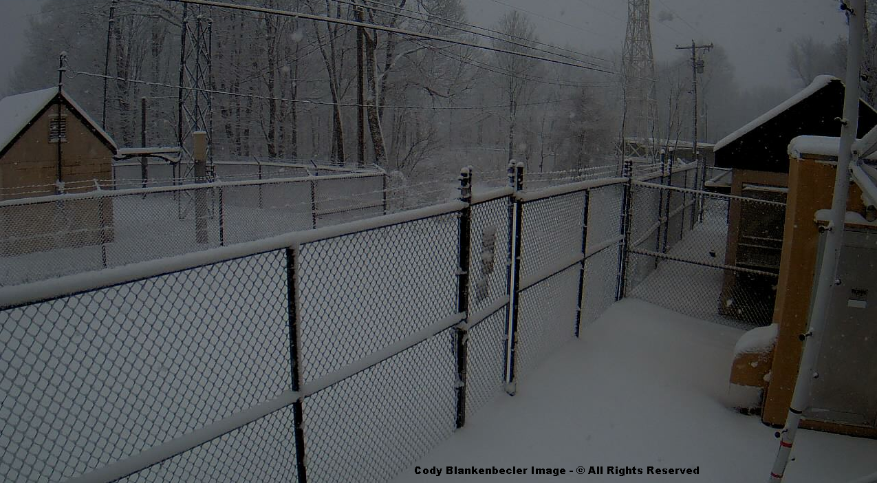
Updated: The Arctic Front snow arrived around 3 AM and produced 45 minutes of heavy-light snow at UVA-Wise and more than 1-hour of driving snow on High Knob ( where it was a horizontal-wind blown fall of snow ). The lee side of a roof top gained more than 4″ between 8:12 PM and 4:27 AM, with numerous snow showers and wind driven squalls.
High Knob Massif Webcam – The Arctic Front Snow Band
Some roads in the high country of the High Knob Massif may become impassible due to blowing & drifting snow into today.
Overnight Into Saturday Morning
Snow showers & squalls. Whiteout conditions at times in squalls ( with hit-miss coverage ). Winds NW-NNW at 10-20 mph, with higher gusts, along middle elevation mountain ridges & plateaus. Winds NW 15-25 mph, with higher gusts, along upper elevation mountain ridges. Becoming bitterly cold by morning. Temperatures varying from 0 degrees at summit levels of the High Knob Massif to lower 10s ( single digits to 10 degrees in Norton-Wise ). Wind chills from 0 to -10 degrees below zero on middle elevation mountain ridges and plateaus, with -10 to -30 degree below zero chill factors in upper elevations above 3000 feet. Blowing-drifting snow along upper elevation ridges.
This Afternoon
A continued chance for flurries. Bitterly cold. NW-NNW winds 10 to 20 mph, with higher gusts, along mid-upper elevation ridges-plateaus. Temperatures varying from single digits at highest elevations in the High Knob Massif to middle to upper 10s, milder lee of the mountains toward the Tri-Cities. Wind chills varying from 0 to -20 below zero in upper elevations to 5 above to -10 below zero along middle elevation ridges.
Tonight Into Sunday Morning
Increasing mid-high clouds. NW-N winds decreasing and shifting easterly into morning. MIN temperatures 0 to 10 degrees ( colder if skies can clear completely for a period of time in places with snow cover ).
Weather Discussion ( February 12-13 )
My Afternoon Update
My update this afternoon features a look at the current forecast, snowfall during the past 24-hours, and what will the next winter storm bring? No rest for the weary!
High Knob Massif Webcam – University Of Virginia’s College At Wise
The only update to my previous forecast is to remove all but flurries, as a few continue northeast of Clintwood, and to raise the PM temperature ever so slightly.
Nora 4 SSE – National Weather Service Site In Middle Elevations
True air temperatures, via official thermometers protected from snow glare, paved surfaces etc…will have a chance to reach into upper 10s for some along the upslope side of the mountains ( I had low-mid 10s ). Lower elevation valleys will possibly crack 20 degrees ( a heat wave ), with milder conditions south of the mountains toward the Tri-Cities.
Black Mountain MesoNET – Observation Up To 1:15 PM Saturday ( Feb 13 )
Highest elevations, especially those above deep snow and on north slopes in the High Knob Massif, will remain in single digits for the entire day ( despite sunshine ).
Eagle Knob of High Knob Massif at 2:23 PM on Saturday ( February 13, 2016 )
Snow glare over a general foot of snow atop the High Knob Massif, with large variations in depth from a wicked overnight period.
A general 2″ to 5″ of snow fell along the upslope side of the mountains during the past 24-hours, coming in at the bottom of my forecast range when including my spread potential which was listed in the forecast.
City of Norton Water Plant
February 12 at 3:00 PM 0.5″
February 12 at 9:00 PM Trace
February 12 at 3:00 AM 1.0″
February 12 at 9:00 AM 1.3″
Snowfall Total: 2.8″
( 6″ Mean Snow Depth )
Snowfall measurements courtesy of Joe Carter & Wes Ward.
*The 3:00 AM total that fell in the Arctic Front snowband had to be partially estimated due to wind blowing the snow off snowboards.
Wes Ward measured 6″ of mean snow depth at the City of Norton Water Plant before sunrise, counting old snow, with Joe Carter measuring 1.3″ of new snowfall between 3 AM and 9 AM as snow showers and local squalls continued.
Snow In High Chaparral of High Knob Massif at 9 AM Saturday – February 13, 2016
My friend Darlene Fields sends out a postcard view of the morning in High Chaparral of the High Knob Massif, with 3.5″ of new snowfall adding to old snow, as some is still falling when this photograph was taken at 9:00 AM.
New snowfall reached at least 5″ up at the summit level of the High Knob Massif, if not a little more, with wicked overnight conditions amid snow, blowing snow, and brutal wind chills. Snowfall with the Clipper reached only 0.5″, so nearly all new snow came via NW Upslope Flow last night into this morning.
On the downslope side of the mountains, with respect to NW Flow, it was a different story with 1.5″ in Jonesville coming almost entirely with the Clipper.
Anna Hess reported much the same in The Pines of the Clinch River Valley, near Dungannon, where 0.8″ of snow fell ( a mere 0.2″ during the NW Flow period as moisture robbing along windward slopes of the massif stole it! ).
Major Winter Storm
These are from 7 AM Model Runs.
Turning focus toward the next major winter storm finds that models today are in rather amazing agreement with respect to total precipitation & axis of heaviest amounts.
I am not allowed to show the European Model, but it has a general 1.50″ to 2.10″ of total precipitation along and west of the High Knob Landform corridor ( similar to the NAM below but somewhat heavier in total amounts ).
NAM 12 KM Model Total Precipitation Forecast – Next 84 Hours
The NAM Model group shows an axis of heaviest precip along the western side of the southern Appalachians.
NAM 4 KM Model Total Precipitation Forecast – Next 60 Hours
This event is not yet fully in view of the high resolution NAM, but the trends in precipitation distribution are clear.
GFS Model Total Precipitation Forecast – Next 96 Hours
The GFS Model has an axis of the heaviest precipitation amounts along the High Knob Landform corridor and the Cumberland Plateau of middle-eastern Tennessee.
GGEM Model Total Precipitation Forecast – Next 96 Hours
The Canadian Model ( GGEM ) is very similar, again with an axis of heaviest precip along the Cumberland Mountains and adjoining Cumberland Plateau ( above ).
JMA Model Total Precipitation Forecast – Next 96 Hours
The JMA Model ( Global Japanese ) also picks up on this same axis with SW-NE orientation in the southern Appalachians.
FIM9 14 KM Model Total Precipitation Forecast – Next 96 Hours
The Flow-following Finite-volume Icosahedral Model, called FIM9 for short ( which divides grids up using polyhedrons into mostly hexagons and 12 pentagons for the globe ) again shows this same type of SW-NE axis of heaviest precip along western slopes of the southern Appalachians.
In summary, as good of agreement as one ever sees from a set of models run for the same time ( 7 AM Run Saturday, February 13, 2016 ). Actually, impressive.
As regards precipitation type, it is not as simple.
Model Snowfall Forecast’s From 12z Run
The European Model, which I am not allowed to show, predicts 6″ at the Wise gridpoint with up to 8″ in the area.
NAM 12 KM Model Total Snowfall Forecast – Next 84 Hours
The NAM Model group is more varied, with 2.9″ to 5.3″ at the Wise gridpoint and locally up to 10″ on the NAM 4 KM ( but it does not extend through the entire event ).
NAM 4 KM Model Total Snowfall Forecast
The GFS Model ( below ) has 3.5″ at the Wise gridpoint with a MAX toward the southwest that goes up to more than 8″ .
GFS Model Total Snowfall Forecast – Next 96 Hours
The Canadian Model ( GGEM below ) predicts 5.1″ at the Wise gridpoint with a MAX also indicated toward the southwest.
GGEM Model Total Snowfall Forecast – Next 96 Hours
The JMA ( Japanese ) snowfall forecast is not available.
FIM9 14 KM Model Total Snowfall Forecast – Next 96 Hours
The FIM9 14 KM Model shows again a snowfall max toward the southwest from Wise, centered across the High Knob Landform corridor.
Initial Thoughts: A heavy precipitation event is coming from Sunday through Monday, with the amount of snowfall being the biggest unknown.
It is clear that all precipitation will begin as snow and continue that way through Sunday into early hours of Monday. Since this is being driven by strong SW flow amid an “open wave” type of setting, it is worrisome since past climatology shows tendency for orographic enhancement along the High Knob Landform sector. This actually seems to be picked up on by some of the models during these morning runs shown above.
Although the flow is not deeply SW, evaporative cooling amid a retreating arctic air mass is going to play a role in the temperature structure of this system. If strong low level inversional conditions form, then strong SW winds can flow above with more limited vertical mixing ( that could keep low-levels colder during much of the event ).
Since models such as the NAM show only limited warming above 850 MB it becomes problematic and could easily trend toward more of the precipitation falling as snow, especially amid the sector where SW air flow rises upward through the High Knob Landform corridor.
I will issue a preliminary snowfall forecast tonight.
The Bottom Line – A Major Winter Storm will begin impacting the mountain region Sunday. Snow is likely to develop into the mid-day to early PM and continue Sunday Night, with hazardous conditions across the region due to bitterly cold temperatures expected into Sunday Morning.
The amount of total snowfall remains uncertain, but 4″ or more looks likely Sunday PM-Sunday Night as snow density initially begins low. Stay tuned for updates on this developing winter storm setting.
Snow showers started increasing during the evening and have been intermixed with squalls in a hit-miss fashion for any given location. Low visibility has occurred in squalls.
High Knob Massif Webcam – University Of Virginia’s College At Wise
Squalls along the actual Arctic Front at 850 MB, which has been followed through the previous evening, are now just northwest of Wise County and will deliver some intense snowfall to places where they strike.
JKL Doppler Radar at 2:13 AM on Saturday ( February 13, 2016 )
Snowfall amounts are going to vary significantly across the area in this type of pattern, even though all locations along the upslope side of the mountains will have accumulation.
NAM 4 KM Model 850 MB Temps-Wind Streamlines at 7 PM Friday
The increase in snow showers and squalls can clearly be seen via the connection to Lake Michigan, with limited activity at 7 PM ( above ) as the flow was passing north of southwest Virginia, then a dramatic increase along the upslope side of the mountains during the evening as the flow turned southward off Lake Michigan ( below ).
NAM 4 KM Model 850 MB Temps-Wind Streamline Forecast – 1 AM Saturday
Squalls up to 1:30 AM have tended to hit repeatedly in some places with 1.5-2″ here at my station in Clintwood. This may even out by morning, and if not then large differences in snow amounts will certainly occur over relatively short distances.
Black Mountain MesoNET Up – Midnight to 1:30 AM Saturday ( February 13 )
Temperatures are dropping with bitterly cold conditions along mid-upper elevation ridges already, well ahead of the coldest air that is still upstream of the mountains ( a plunge to come shortly after passage of the 850 MB Arctic Front ).
A Major Winter Storm is on tap for the mountain area beginning late Sunday and lasting into early Tuesday. Details, are yet to be worked out; although, precip is looking to be very significant. Figuring out how much falls as snow, frozen, rain is impossible at this point. Lets hope the next 24-hours will bring more model agreement on storm track, intensity, amounts.
The JMA ( Japanese ) Model and Canadian Model have it as all snow, while the NAM, GFS, and European show significant snow to rain before a change back to snow. But they differ significantly in the important details, such as track, which would greatly help if known for certain via past climatology of such storm tracks.
ALERT For Accumulating Snow Developing Today With Heavy Snow In Upslope Locales Tonight Into Saturday.
Extremely Bad Conditions Are Expected To Develop As Temperatures Drop – Dangerous Cold Will Develop Late Friday Night Into Saturday-Sunday AM
Snowfall Forecast From Friday Into Saturday Night
With respect to the High Knob Landform corridor, the area within the yellow on my forecast graphic possesses the greatest uncertainty for snowfall totals, depending upon the Clipper track and amount of snow which can penetrate into the Powell River basin on NW flow. The area possessing the highest certainty is upper elevations of the High Knob Massif where 4-8″ or locally more will be possible.
Target Snowfall of 4.5″ in Norton-Wise ( +/- ) 1.5″ spread potential. This implies potential for 3″ to 6″ of snowfall in the Norton-Wise area, with locally heavier amounts likely in upper elevations of the High Knob Massif from today into Saturday Night.
A widespread general snowfall will develop today with a fast moving Alberta Clipper System. The bulk of accumulation leeward of the Cumberland Mountains is expected with this system before NW Upslope Flow snow showers, squalls, and snowstreaks develop tonight into Saturday. Due to recent bitter cold, travel conditions are expected to become hazardous across the region with an axis of heavier snow along and/or south of the High Knob Massif into the Great Valley of NE Tennessee with the Clipper.
Potential of a Major Winter Storm Is Increasing for February 15-16. Please stay tuned for updates.
Overnight Into Mid-Morning Friday
Increasing clouds with snow developing between sunrise and mid-morning ( especially along and south of a Harlan to Wise line ). Winds becoming S-SW at 5-15 mph, with higher gusts, across mid to upper elevation mountain ridges and plateaus. Temperatures in the 10s to low 20s, tending to rise some into morning.
Mid-Morning Through This Afternoon
A period of steady snow giving way to flurries and/or a brief break prior to snow showers increasing late within the upslope zone with respect to W-NW winds ( areas inside RED on my snowfall forecast graphic above ). Winds becoming W-WNW at 5-15 mph, with higher gusts. Temperatures varying from low 20s to low 30s ( coldest at highest elevations ). Wind chills in the 10s and 20s.
An organized band of intense snow, with whiteout conditions, will become possible by the late evening-Midnight period with arrival and passage of an Arctic Front ( stay tuned for better timing ).
Tonight Into Saturday Morning
Snow showers & squalls. Whiteout conditions at times in squalls ( with a hit-miss coverage ). Winds becoming NW-NNW at 10-20 mph, with higher gusts. Becoming bitterly cold by morning. Temperatures varying from 0 degrees at summit levels of the High Knob Massif to lower 10s ( single digits to 10 degrees in Norton-Wise ) by morning. Wind chills from 0 to -10 degrees below zero on middle elevation mountain ridges and plateaus, with -10 to -30 degree below zero chills in upper elevations above 3000 feet.
Blowing & drifting snow will develop tonight into Saturday at exposed middle to upper elevations. Some roads in the high country of the High Knob Massif may become impassible.
Weather Discussion ( February 11-12 )
My Afternoon Update
No changes to my forecast this afternoon with everything being on track. A general 0.5″ to 1″ of snow was reported with the clipper system this morning, with highest totals toward the south ( as figured ) where Big Stone Gap got more than the City of Norton ( Around 1″ verses 0.5″ ).
The most snow fell across southern locations south of the High Knob Massif in the Great Valley of NE Tennessee from Bristol southwest to Gatlinburg.
High Knob Massif Webcam – University Of Virginia’s College At Wise
Orographic clouds are laying low across the High Knob Massif, waiting now for the bitter air to help generate the real snow.
Eagle Knob of High Knob Massif ( 20 Degrees ) at 3:49 PM ( February 12 )
There is sure a bounty of cold air poised to drop down.
European Model 850 MB TEMP & Surface Analysis – 7 AM Friday ( Feb 12 )
Temperatures today have ended up colder than the models predicted, and right within my forecast range of lower 20s to lower 30s ( coldest at highest elevations ).
Black Mountain MesoNET Observations
Temperatures have been hovering in the upper 20s ( LNP says 30 but all other available sites report upper 20s ) in Norton-Wise.
Lonesome Pine Airport In Wise
It is now merely a waiting period for Great Lake moisture to come south with the bitter air upstream of the mountains.
Regional Doppler Composite at 3:58 PM Friday – February 12, 2016
Timing on the Arctic Cold Front is a little slower on the latest high resolution NAM 4 KM Model, with it being near the VA-KY border by around 1:00 AM. So some time from late evening into the early overnight period. Increasingly severe conditions develop along and behind the Arctic Front into Saturday Morning.
NAM 4 KM Model Future Doppler Forecast – 1 AM Saturday ( February 13 )
Meanwhile, light snow and snow showers will be developing during the evening in advance of the Arctic Front.
JKL Doppler at 4:37 PM on Friday – February 12, 2016
Light snow is falling now, as the most sensitive mode of the Doppler is barely able to detect, in Clintwood at 4:37 PM.
My Overnight Discussion
The picture of the day highlights conditions atop the sprawling High Knob Massif as the first rays of sunshine broke through the low overcast on Thursday morning.
Eagle Knob of High Knob Massif – February 11, 2016 at 9:46 AM
The view from UVA-Wise around the same time.
High Knob Massif Webcam
Thursday again featured colder than average conditions with PM MAXS varying from 28 degrees in Clintwood to around 18 degrees at the High Knob summit level.
Nora 4 SSE – Official NWS Recording Site at Middle Elevations
Beautiful skies ended the day…
High Knob Massif Webcam – University Of Virginia’s College At Wise
with a deep, settled snowpack atop the High Knob Massif.
Eagle Knob of High Knob Massif – February 11, 2016 at 5:41 PM
Some serious winter is on tap for the mountain region through early next week, with it beginning today as an Alberta Clipper races southeast into a digging trough.
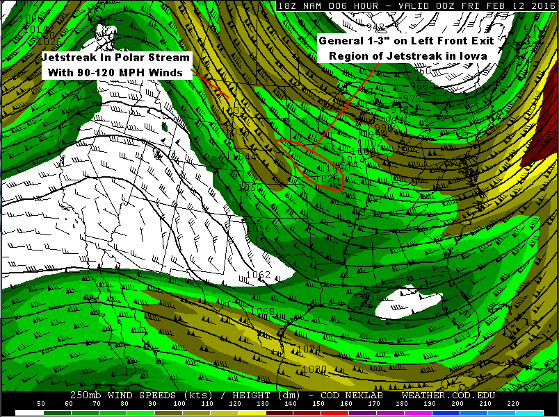
Jetstreak Above Iowa With Clipper System – 7 PM NAM Model Forecast
A general 1-3″ of snow fell upstream with the Clipper as it crossed Iowa, with 2.2″ at last report officially measured at the Des Moines NWS Office. The snow was on the nose of a polar jetstreak.
NAM Model 250 MB Forecast At 1:00 PM Today – Friday ( February 12 )
Following the jetstreak downstream it is easy to see that the left front exit region zone of high altitude lifting will be moving into the Mountain Empire, with a bias toward the southern areas if model runs at 00z ( 7 PM Thursday ) are on target.
HRRR Model Future Doppler Forecast at 8 AM Today – Friday ( February 12 )HRRR Model Future Doppler Forecast at 10 AM Today – Friday ( February 12 )
I am glad that the NWS Forecast Office in Morristown, Tn., expanded its Advisory to cover counties in the Great Valley since conditions are likely to become hazardous.
The mean of past climatology of clippers tracking SE from the Iowa area is that snow density tends toward 20:1, which will especially be true in this case given arctic air. Echoes on Doppler will initially evaporate before reaching the surface as the lower levels remain relatively dry.
This will act over time to enhance cooling and work at offsetting some of the warm air transport aloft. Since winds below 4000 feet are not predicted to be that strong, there is a good chance that low-level temperatures will end up being colder than models predict. This being especially true since clear early evening skies have allowed for good temperature drops in valleys. Much like what happened with the January 20 clipper system.
GFS Model 850 MB Wind Streamline & MSLP Forecast – 1 AM Saturday ( Feb 13 )
The main difference between this clipper and the one back in January is that it will be followed by an Arctic Front that has an excellent Great Lake connection. This will CRANK snow showers and squalls along the upslope side of the southern-central Appalachians tonight into Saturday.
European Model 850 MB TEMP-Streamline & MSLP Forecast – 7 AM Saturday
An organized band of intense snow squalls is likely to develop and move southeast into the windward side of the Cumberland Mountain Friday evening, with rough timing obtained by using the 850 MB Theta-E pattern forecast.
NAM Model 850 MB Theta-E Forecast at 10:00 PM Friday ( February 12, 2016 )
The Arctic Front should be amid the DARK BLUE band shown on the above Theta-E forecast chart, which would roughly place it at the Virginia-Kentucky border by 10:00 PM tonight. Timing on this, of course, being subject to change since this front will be developing over time today as bitter air surges south from Canada.
While some snow showers and squalls may form in advance of the front, it will be along and behind the Arctic Boundary that conditions become increasingly severe overnight into Saturday morning on excellent NW Upslope flow.
European Model 850 MB TEMP-Wind Streamline & MSLP Forecast – 7 PM Feb 13
The LSLM ( Limiting Streamline for Lake Moisture ) is forecast to be along and northeast of the Great Smokies, so the best snow squalls should develop along-northeast of the Smokies with very little snow southwest of this streamline ( e.g., SW portion of NC ).
If this streamline forecast verifies, the High Knob Massif is in a prime location where past climatology of MANY such events show heavy snow is a given ( with riming and enhanced orographics ).
Snow showers are likely to continue into Saturday Night along the upslope side of the mountains as the coldest air mass of this winter season grips the region.
With any clearing by Sunday Morning temperatures could drop well below ZERO. The amount of clouds, snow showers-flurries into that time remains to be determined for upslope locations.
It will be at least another day before models can get a handle on a Major Winter Storm system that begins to impact the mountain area by late Sunday into Monday.
The Bottom Line…A Harsh Period of Winter Will Be Gripping The Mountain Empire From Tonight Thru This Weekend Into Early Next Week – Dangerously Cold Temperatures And Simply Hazardous Outdoor Conditions For Humans & Pets. Please remain safe.
ALERT For Bitterly Cold Temperatures-Wind Chills Continues Into Today. This Pattern Will Continue Through This Weekend Into Next Week To Mark A Harsh Period Of Winter In The Appalachians.
Please Remain Alert For Hazardous Traveling Conditions As Well As Ice On Decks-Porches-Walks.
An Alert For Heavy Snow Squalls May Be Needed For Friday Night Into Saturday, With Significant Snow Accumulations Along And NW Of The High Knob Massif & The Tennessee Valley Divide that will tend to create very bad road conditions with plunging temps.
Bitterly cold conditions are expected Saturday into Sunday as part of the Polar Vortex gets stretched southward into the Great Lakes and NE USA ( in wake of major upper stratospheric warming ).
Potential of a Major Winter Storm Is Increasing for February 15-16. Please stay tuned for updates.
Overnight Into Thursday Morning
Mostly cloudy & bitter. Light snow and snow showers. Winds W-WNW 5-15 mph, with higher gusts, along middle elevation ridges & plateaus below 2700 ft. WNW-NW winds 10-20 mph, with higher gusts, on upper elevation ridges. Temperatures varying from 0 to 5 degrees at the highest elevations to lower 10s. Wind chill factors varying from single digits to as cold as -10 to -20 below zero on upper elevation ridges.
Mid-Morning Through This Afternoon
Becoming mostly sunny. Cold. Light WNW-N winds at generally less than 10 mph. Temperatures varying from middle to upper 10s at highest elevations to mid-upper 20s ( a little milder in lower elevation valleys with little to no snow cover within portions of the Clinch, Powell, Holston river valleys toward the Tri-Cities ).
Tonight Into Friday Morning
Increasing clouds. Winds becoming S-SW at 5-15 mph, with higher gusts, across mid-upper elevation mountain ridges and plateaus. Temperatures in the 10s to low 20s, tending to rise at higher elevations into morning.
Some accumulating snow will be possible with a Clipper System during the day Friday, with heaviest snowfall likely to develop in NW Flow upslope locations Friday Night into Saturday.
Weather Discussion ( February 10-11 )
Reference my 021016 Forecast for details on snow accumulations which have varied from locally 1″ or less in portions of the Clinch and Powell river valleys up to 10-18″ across windward slopes and crest lines of the High Knob Massif.
The air is so cold that as long as any lower clouds are along upslope locations, especially windward sides of the great High Knob Massif, some flakes of snow will continue ( as have been observed this evening on Eagle Knob ).
High Knob Massif Webcam – University Of Virginia’s College At Wise
Snow and low clouds broke just in time for sunset to be revealed in its glorious beauty above the snow covered mountain landscape.
High Knob Massif Webcam – University Of Virginia’s College At Wise
Wednesday afternoon temperatures were bitter cold with widespread 10s across middle elevations and single digits amid upper elevations ( above 3000 feet ). A few lower elevation valleys managed to break above 20 degrees.
Nora 4 SSE – Official National Weather Service Site In Middle Elevations
Wind chills as cold as -10 below zero occurred at Nora 4 SSE.
Relative humidity remained high along windward slopes all day, with continuous light snow and heavier snow showers in localized hit-miss fashion ( for the snow showers ).
Black Mountain MesoNET – Observations During Past 24-Hours
Temperatures have actually been rising a little at highest elevations during the evening, but wind gusts have been increasing to generate chill factors between -15 and -20 degrees below zero along high mountain crest lines.
Black Mountain MesoNET Up To 12:15 AM – February 11, 2016
Generally, it appears that clouds will remain abundant along the upslope side of the mountains into this morning before finally giving way to clearing.
JKL Doppler At 1:47 AM on Thursday – February 11, 2016
In fact, more light snow accumulations are likely along windward facing slopes within upper elevations of the High Knob Massif overnight, with flurries and light snow amid lower-middle elevations having a chance to slicken a few roads that have cleared in Wise-Dickenson counties.
It will take very little to do that given current air temperatures.
European Model 850 MB TEMP & Surface Analysis – 7 PM February 10, 2016
The coldest air with this first arctic blast ( the axis of the 850 MB thermal MIN ) will begin to shift northeast of the mountain area by morning.
European Model 150 MB Forecast at 7 AM on February 12, 2016
Focus now shifts to both a temporary stretching and southward extension of the Polar Vortex ( above ) and a very active upstream array of energy across the Pacific Ocean.
Eastern Pacific Water Vapor Image At 12:01 AM – February 11, 2016
Following a break today the pattern quickly turns active again with a Clipper System diving down into the base of another deepening USA trough Friday.
Light snow will spread across the region during the day Friday, in advance of another blast of bitter air arriving Friday Night into Saturday. Along with this a Great Lake connected NW Flow period will crank up intense snow squalls along the upslope side of the mountains Friday Night into Saturday along-behind an Arctic Front.
My preliminary projection is for 1″ to 3″ of snow across the area in general, with 3″ to 6″ in favored upslope locations along and north of the High Knob Massif & Tennessee Valley Divide ( generally the most being in upper elevations of the massif above 3000 feet ). Stay tuned as I will make an actual forecast tomorrow night.
ECMWF Ensemble Mean Sea Level Pressure Anomaly Forecast – 7 AM Monday
Models will require a couple more days before the details of a potentially major early week storm system can be figured out, with energy for this system still in the Pacific Ocean.
There is plenty enough ensemble support in the 51-Member European Model cluster to warrant that this will be one to closely watch and flag now for the potential of significant wintry precipitation. Stay tuned.
ALERT For Bitterly Cold Temperatures-Wind Chills Today Into Thursday AM. This Pattern Will Continue Through This Weekend Into Next Week To Mark A Harsh Period Of Winter In The Appalachians.
Please Remain Alert For Hazardous Traveling Conditions As Well As Ice On Decks-Porches-Walks.
Some additional light snow accumulations will be possible through today, with locally heavier amounts along windward slopes of the High Knob Massif & Black Mountain. Much of the middle-upper elevations will again remain in 10s & single digits through today ( coldest conditions at the highest elevations ).
Potential for additional heavy snow is being monitored for the Friday-Saturday period with a Clipper System leading a Major Arctic Outbreak ( with Great Lake connected NW Upslope Flow Snowfall following the upper air disturbance & Arctic Front ).
Bitterly cold conditions are expected by Saturday into Sunday as part of the Polar Vortex gets stretched southward into the Great Lakes and NE USA.
Potential for a Major Winter Storm is being monitored for the period from late in this weekend into early next week.
Overnight Into Wednesday Morning
Light snow & snow showers. Local bursts of heavier snow. Bitter cold. Winds W to NW at 5-15 mph, with higher gusts along mid to upper elevation mountain ridges & plateaus. Blowing and drifting snow with riming at high elevations. Temps from single digits at highest elevations to 10s in Norton-Wise ( milder in lower elevations toward the Tri-Cities ). Wind chill factors in single digits above & below zero, except wind chills as low as -10 to -15 below zero at highest elevations.
This Afternoon
Mostly cloudy ( some hazy sunshine possible ) with a continued chance for light snow, flurries, and heavier local snow showers. Bitter cold. W to NW winds 10-20 mph with higher gusts. Blowing snow on exposed mid-upper ridges. Temperatures varying from the single digits at highest elevations to the mid 10s-low 20s, mildest at low elevations in the Clinch, Powell, Holston river valleys toward the Tri-Cities. Wind chills in the single digits above and below zero, except -5 to -15 below along upper elevation ridges.
Tonight Into Thursday Morning
Mostly cloudy & bitter. Chance of flurries & snow showers. Winds W-WNW 5-15 mph, with higher gusts, along middle elevation ridges & plateaus below 2700 feet. WNW winds 10-20 mph, with higher gusts, on upper elevation ridges. Temperatures varying from 0 to 5 degrees at the highest elevations to lower 10s. Wind chill factors varying from single digits to as cold as -10 to -20 below zero on upper elevation ridges.
Weather Discussion ( February 9-10 )
My Afternoon Update
The only update to my forecast for this afternoon was to increase wind speeds a little, and add blowing snow for the higher mountain ridges ( especially in upper elevations of the High Knob Massif where snow is deep ).
Snow & Blowing Snow – Eagle Knob of High Knob Massif – 2:45 PM February 10
At 2:45 PM the air temperature was 6 degrees on Eagle Knob with wind chill factors as low as -15 degrees below zero. The snowfall total had reached around 18.0″ at 3 PM with large variations in ground depths due to blowing-drifting and settlement.
Joe & Darlene Fields measured 2.5″ of new snow up to 9 AM Wednesday to bring the storm snowfall total to 12.7″ in the High Chaparral community of the High Knob Massif. More snow has fallen & accumulated since that time.
Deep Fluff In High Chaparral of High Knob Massif – 8:50 AM February 10
Joe & Darlene Fields measured 0.5″ more at 4:00 PM to bring their storm snowfall total to 13.2″ in High Chaparral. The mean snow depth was 8″ with a southern exposure there.
*They also lost 1″ of snow depth with melting on February 8 before the colder air and steady snow developed. This illustrates why it is important to measure snowfall using the official method since the combination of many factors work to change ground depths.
If one had only looked at the 8″ depths observed at both the City of Norton Water Plant ( on a north slope ) and in High Chaparral ( south exposure ) it might be assumed that snowfall was the same. However, by measuring the proper way it can be seen that snowfall was greater in High Chaparral than at the Norton Water Plant ( 3.5″ more in High Chaparral ).
There has been more drifting in the High Chaparral area, especially at more exposed sites and in higher elevations where more snow fell from Bowman Mountain to Little Mountain and the head of Big Cherry Lake basin ( but I’m just comparing points for illustration of how mere snow depth alone can be deceptive when not considering the big picture ).
Below is a look at conditions on Stone Mountain Road, up from Tacoma in Wise County ( State Route 706 ), at 1:00 PM this afternoon. It is easy to see why school is closed in Wise County ( remember hundreds of folks live above 3000 feet along the Wise-Scott border area in the High Knob Massif as was well documented by Jessica Swinney in a 2008 study ).
Stone Mountain Road from Tacoma ( State Route 706 ) at 1 PM February 10, 2016
Superintendent Andrew Greear reported 1.4″ of new snow accumulation at the City of Norton Water Plant between 9:00 AM and 3:00 PM today ( Wednesday, February 10 ).
This brings the official storm snowfall total to 9.7″, with around 8″ ( 7-8″ ) currently on the ground at this northern base of the High Knob Massif ( nearly twice this much has fallen at the summit level nearly 2000 vertical feet higher ).
This is a very accurate measurement and has followed the official NWS and University of Colorado Guidelines for measuring snow.
City of Norton Water Plant
February 8 at 10:00 PM 2.2″
February 9 at 4:00 AM 1.9″
February 9 at 9:00 AM 1.5″
February 9 at 3:00 PM 0.7″
February 9 at 9:00 PM 0.5″
February 10 at 3:30 AM 1.0″
February 10 at 9:00 AM 0.5″
February 10 at 3:00 PM 1.4″
Snowfall Total: 9.7″
( 7-8″ of Snow Depth )
*Snowfall measurements courtesy of Scott Craft, Andrew Greear, Caleb Ramsey, Wes Ward, and Joe Carter.
The water equivalent total has been around 0.50″ on nearly 10″ of snow ( 20:1 density ), with the density dropping during the second half of this event at the Norton Water Plant ( i.e., ratio of snow to water has been increasing as the air has turned bitter in Norton ).
This may not be the case atop the High Knob Massif, with only a snow core being able to reveal the results. Past experiences where I have taken cores ( as recently as January 31 ) show that riming of snowflakes adds to the water content along with a tendency when air temperatures get around and below 10 degrees for the density of snow to naturally increase. So the water content on 12-18″ of snowfall up above is likely significantly more than that obtained down in the City of Norton.
High Knob Massif Webcam – University Of Virginia’s College At Wise
The High Knob Massif has been obscured in snow and clouds for days and is only now becoming partially visible along the horizon as moisture finally begins to decrease.
My Overnight Discussion
This active winter pattern is only going to get wilder in coming days, with multiple threats being watched from this current system through the weekend into early next week.
Wes Ward measured an additional 1.0″ of new snow at the City of Norton Water Plant at 3:30 AM to bring the current tally to 7.8″ ( with 6-7″ of settled snow depth ).
City of Norton Water Plant
February 8 at 10:00 PM 2.2″
February 9 at 4:00 AM 1.9″
February 9 at 9:00 AM 1.5″
February 9 at 3:00 PM 0.7″
February 9 at 9:00 PM 0.5″
February 10 at 3:30 AM 1.0″
Snowfall Total: 7.8″
( 7″ of Snow Depth )
*Snowfall measurements courtesy of Scott Craft, Andrew Greear, Caleb Ramsey & Wes Ward.
Reference my 020916 Forecast for details on earlier snow amounts.
High Knob Massif Webcam – University Of Virginia’s College At Wise
Light snow which has never stopped falling along upslope sides of the mountains is picking up a little in intensity, with redevelopment of heavier localized snow showers and snowstreaks ( narrow bands of snow that follow along low to mid-level wind trajectories ), during the late evening-early overnight period.
This has been expected all along as the coldest 850 MB air is still to arrive, along with continuation of 700 MB moisture until early PM. It will not be until mid-late this afternoon that some hazy sun can become more common, and due to very cold air remaining aloft, it could help develop a few heavier snow showers or narrow streaks.
With temperatures now so cold it will not take much snow to make even cleared roads slick, so please slow down and use extreme caution outside through today.
Nora 4 SSE – Official National Weather Service Site In Middle Elevations
I like to use Nora 4 SSE observtions since it is a good calibrated site that is representative of middle elevations across the Norton-Wise & Sandy Ridge areas of Wise & Dickenson counties.
Tuesday temperatures remained in the 10s at most middle elevation sites across Wise & Dickenson counties, with upper single digits to around 10 degrees at the highest elevations in the High Knob Massif & Black Mountain.
Black Mountain MesoNET Up To Midnight – February 10, 2016
Extensive riming has occurred in upper elevations of both the High Knob Massif and Black Mountain, with near saturated air through the afternoon amid bitter temperatures and snow.
A persistent and gusty W-NW wind has made conditions very bitter with chill factors between 0 and -15 degrees below zero along these high mountain crestlines.
Black Mountain MesoNET – Afternoon Wind Graph
This system has possessed abundant mid-level moisture and very cold air aloft that has enhanced instability. Snowfall has been widespread across a wide region and varied in the accumulations due to a number of factors such as the prior warmth-rain of early February, low density snow that tends to settle and/or melt-sublimate faster than wet snow, and a W-NW flow which biases heaviest amounts to windward sides of major mountain barriers like the High Knob Massif.
Once again, this system lacks a Great Lake connected NW flow into the southern Appalachians. Even though windward slopes & crests of the High Knob Massif have again done very well with snowfall, it would have been much heavier had the trajectory crossed the still open expanse of the Great Lakes.
NAM 12 KM Model Backward Airflow Trajectory
An actual Great Lake connected NW Flow might finally develop by late week, along and behind an Arctic Front and upper air wave leading the way for a brutally cold mass of air that will be an actual part of the Polar Vortex that gets temporarily stretched southward in the immediate wake of a major upper stratospheric warming event.
European Model 150 MB Forecast – 7 AM Friday on February 12, 2016
Observe how a piece of the Polar Vortex temporarily breaks away from the main vortex center toward the Great Lakes and NE USA which will be the target of the most brutal air.
European Model 150 MB Forecast – 7 AM Saturday on February 13, 2016
What happens just beyond this time into early next week will be a major concern for the Appalachians, with details still to be worked out by models as arctic air retreats.
ALERT For Accumulating Snow Tonight Into Thursday Morning With Bitterly Cold Temperatures-Wind Chills During Tuesday Into Thursday. This Pattern Is Likely To Continue Through This Weekend Into Next Week To Mark A Harsh Period Of Winter In The Appalachians.
Snow covered & hazardous road conditions will continue and worsen overnight into Tuesday morning as temps drop. Travel is not recommended unless absolutely necessary. Please use extreme caution if traveling overnight.
Overnight Into Tuesday Morning
Light snow, snow showers & bursts of heavy snow. Turning bitter into morning. W-WNW winds 5-15 mph, with higher gusts, at elevations below 2700 feet. Winds W-NW 10-20 mph, with higher gusts, upper elevation mountain ridges. Blowing & drifting snow at high elevations. Temperatures dropping into low 10s at highest elevations and into upper 10s to lower-middle 20s at lower-middle elevations ( near 10 degrees at the summit of High Knob Massif ). Wind chills dropping into single digits & 10s, except 0 to -15 below zero across upper elevations in the High Knob Massif & Black Mountain. Extensive rime formation at high elevations.
This Afternoon
Light snow & snow showers. Local bursts of heavier snow. Cold. Winds W to NW at 5-15 mph, with higher gusts, along middle-upper elevation mountain ridges-plateaus ( blowing & drifting snow at exposed middle-high elevations, riming at high elevations ). Temperatures varying from 10s above 3000 feet to lower-middle 20s ( milder in the Clinch, Powell, Holston river valleys toward the Tri-Cities ). Wind chills in the single digits and 10s, with sub-zero values in gusts along high mountain crestlines.
Tonight Into Wednesday Morning
Snow & snow showers. Local bursts of heavier snow. Bitter. Winds W to NW at 5-15 mph, with higher gusts, along mid-upper elevation mountain ridges & plateaus. Blowing and drifting snow with riming at high elevations. Temps from single digits at highest elevations to the 10s in Norton-Wise ( milder in lower elevations toward the Tri-Cities ). Wind chills in single digits above & below zero ( coldest at high elevations, with WCF’s as low as -10 to -15 below zero ).
New Snowfall – Tonight Thru Wednesday
A general 4″ to 8″+ along upslope side of mountains
( Target storm snowfall total of 8″ in Norton-Wise )
1″ to 4″ on downslope side of mountains
Target storm snowfall total ( for entire event ) remains at 8″ for Norton-Wise ( +/- ) 2″ to imply a potential for 6″ to 10″ . A general 2″ to 3″ had accumulated up to Midnight on Feb 8 in Norton-Wise.
Target storm snowfall total ( for entire event ) is 8″ to 14″+ for upper elevations in the High Knob Massif. A general 5″ to 6″ had fallen up to Midnight on February 8 at elevations above 3200 ft.
Snow depths at any given time, outside of drifting, are expected to be less than total snowfall by 1-3″ due to melting-sublimation and settlement over time during this prolonged event.
Storm total extremes are expected to vary from more than 12″ amid highest elevations in the High Knob Massif to 3″ or less in portions of the Tennessee Valley ( downslope of mountains ).
This snowfall will occur over a prolonged period of time and generally be of low to very low density ( fluffy ). This tends to enhance settlement over time as snow depth increases. Note storm snowfall totals are between Monday AM and Thursday AM ( i.e., snowfall totals by Thursday Morning are currently projected to reach forecast storm total values ).
A prolonged rime event is expected for upper elevations, above 3300 feet, in the sprawling High Knob Massif where significant accumulations are likely during the next few days.
Weather Discussion ( February 8-9 )
My Afternoon Update
As of 9:00 AM, Superintendent Andrew Greear and Caleb Ramsey reported that total snowfall had reached 5.6″ at the City of Norton Water Plant ( 1.5″ of new snow accumulated during the 4:00 to 9:00 AM period ).
The official 8″-diameter National Weather Service rain gauge total reached 0.37″ for the water content on 5.6″ of snow, making for a 15:1 density ( snow to water ratio ) at the City of Norton WP.
3:00 PM Update: Caleb Ramsey reported only 0.7″ of new snow at the Norton Water Plant at 3 PM. This makes an event total of 6.3″ ( 6″ currently on the ground ).
Cody Blankenbecler reported 4″ of snow depth on East Park Avenue in downtown Norton, where some snow has melted, of course, along the pavement ( just after 4:30 PM ).
High above, on Eagle Knob of the High Knob Massif, around 2.0″ of new snow has accumulated to bring the storm tally to 13.0″ ( with moderate-heavy snow during the past hour ).
Deep Snow In High Chaparral of High Knob Massif at 4:00 PM on February 9, 2016
Joe & Darlene Fields confirm the new snowfall with 2.0″ of new snow reported in High Chaparral, to bring the storm tally to 10.2″ at their home ( elevation 3300 feet ) at 4 PM.
High Knob Massif Webcam – University Of Virginia’s College At Wise
There have been some significant snow depth variations around Wise due to ground temperatures and wind in combination with this low density snow ( note I had anticipated that and have had it in my forecast during the past couple of days ). The most snow being held on colder, north slopes and more sheltered locations.
At 9:30 AM, Joe & Darlene Fields reported a snowfall total of 8.2″ in High Chaparral of the High Knob Massif ( including 1″ which fell and melted during the day yesterday ).
Eagle Knob of High Knob Massif at 2:35 PM – February 9, 2016
The air temp on Eagle Knob has been hovering around 9 degrees this afternoon, with wind chill factors as low as -10 below zero at times in gusts on NW winds. Snow is falling steadily and cloud bases have temporarily lifted off the summit to reveal extensive riming of trees.
At around the same time ( 9-10 AM ), the snowfall total on Eagle Knob of the High Knob Massif reached approximately 11.0″, with more than a foot of snow depth in many places.
By rather dramatic contrast, Chris Allgyer measured only 0.5″ on his deck in Big Stone Gap at 9:00 AM this morning.
Likewise, lee of the massif, in The Pines area of the Clinch River Valley near Dungannon, Anna Hess reported only 0.8″ of snow depth this morning.
To the north, here in Clintwood, I’d had 3.0″ of snowfall with a mean depth of 2″ on the ground.
My Overnight Discussion
As of Midnight, and the beginning of another day, snow depth reports varied from 1-2″ in Clintwood to around 3″ across Norton-Wise and 5″ to 6″+ amid upper elevations of the High Knob Massif ( above 3000 feet ).
4:00 AM Update: Scott Craft measured 1.9″ of new snow at the City of Norton Water Plant ( fell during 10 PM to 4 AM period ). This makes a storm snowfall total of 4.1″ and a depth of 4″ at the northern base of the High Knob Massif.
Scott Craft measured 2.2″ up to 10:00 PM on February 8.
Simply gorgeous scenes were captured around sunset.
High Knob Massif Webcam – University Of Virginia’s College At WiseHigh Knob Massif Webcam – University Of Virginia’s College At WiseHigh Knob Massif Webcam – University Of Virginia’s College At Wise
The evening featured continuous snow with intervals of moderate to heavy snow. Darlene Fields shows large flakes falling furiously in High Chaparral around 9:30 PM.
Snow Falling In High Chaparral of High Knob Massif at 9:28 PM ( Feb 8 )
Roads in Wise became covered by around 11:00 PM.
High Knob Massif Webcam – University Of Virginia’s College At Wise
Temperatures have been dropping with 10s across highest elevations ( wind chills around 0 degrees in gusts ).
Black Mountain MesoNET Up To 1:15 AM – February 9 ( Elevation 4031 feet )
There was some interest in thundersnow Monday. When I was outside taking these photographs I heard a rumble that certainly sounded like thunder ( falling snow muffles sound waves and unless the thundersnow is close by it is difficult to hear from a distance ). I have documented thundersnow many times in the High Knob Massif area.
Convective Snow Burst In Clintwood at 2:56 PM – February 8, 2016
There are several different ways, of course, to photograph snow falling. One can set the shutter speed slow and have it silk out into streaks or set it fast to stop motion. You can also set it intermediately, as I did above, for a little of both affects.
Theta-E & Momentum Surface Cross-Section At 7 AM – February 8, 2016
The above cross-section is taken along a line through the High Knob Massif area, from near the Ohio River in western Kentucky into central portions of North Carolina ( eastward of the Appalachians ). Ideally, these cross sections should be taken perpendicular to the Thermal Wind in the mid troposphere, which I did approximately here since the 700-500 MB flow field was SW in nature early this morning ( the cross-section WNW-ESE ).
I have to first give credit to the late Dr. James T. Moore of Saint Louis University for teaching me about thundersnow following a major local event during March 1995 ( up to 15″ of snow depth accumulated atop the High Knob Massif in a prolonged thundersnow event that lasted for hours ).
Dr. Moore was the king of Isentropic Analysis and a very kind man. He was a true teacher and contributed greatly to the advance of meteorological science.
The March 8, 1995 setting was much different from today but the principles are the same. Conditional Symmetric Instability ( CSI ) is what one is looking for as during most thundersnow events clouds are not vertical. The air mass may, in fact, be stable with respect to vertical ascent but is unstable with respect to slantwise motion. Cloud tops may be less than 20,000 vertical feet tall but the convection can reach up to 40,000+ feet in a tilted or slantwise direction.
Such slantwise convective requires the slope of Momentum Surfaces ( which I have plotted above in brown ) to be more shallow ( less steep ) than the slope of Equivalent Potential Temperature ( called Theta-E ) Surfaces ( which I have in a green color above for the 7 AM Analysis on February 8 ).
The atmospheric state this morning featured a relatively large region with Potential Symmetric Instability since the air mass was not saturated within the layers in which I have roughly outlined ( in red ) where the requirements for CSI were present. With forced lifting to saturation this state could have been converted into CSI, and ended up being in places with good lifting during the afternoon. CSI is strictly defined only in a saturated environment with a lapse rate that is nearly moist-adiabatic in nature.
Approximately in the middle of the cross-section is an area where Theta-E decreases with height to indicate convective instability. CSI & Convective Instability can co-exist, but the upright convection will typically dominate.
Focus during this 36-hour forecast cycle by short-range models are wanting to place the emphasis for heaviest snow across southern Ohio.
NAM 4 KM Model Total Snowfall Forecast To 7 AM Wednesday – 7 PM Run
With abundant 700 MB moisture, cyclonic flow, and cold air advection into the mountains on W-NW flow it is difficult to not accumulate snow, at least at middle-upper elevations.
*Any time air is this cold aloft a RH of 70% or greater at 700 MB is significant, especially amid cyclonic flow. It will be surprising if the upcoming day is void of snow showers and local squalls along the mountains.
NAM 4 KM Model Total Snowfall Forecast To 7 AM Wednesday – 1 AM Run
All models have already greatly under-estimated snowfall in the High Knob Massif & Norton-Wise area up to this point in time, and are very likely also under-estimating snowfall through Wednesday. So for now, I have kept my original snow forecast numbers ( which are to Thursday AM ), and can update later today or tonight if needed.
While many always are interested in snow, the real deal upcoming is bitter cold that will intensify today into Wednesday ( temperatures during the daylight hours of Wednesday will struggle in the 10s in Wise and Norton ). Longer days will help some, but this air mass and the next one upcoming by this weekend are of true arctic origin. The actual Polar Vortex will be stretched enough to push the most bitter air of the entire winter season into the area by late Friday into Saturday ( followed by a potentially heavy snow ).
ALERT For Accumulating Snow Today Into Thursday Morning With Bitterly Cold Temperatures-Wind Chills During Tuesday Into Thursday. This Pattern Is Likely To Continue Through This Weekend Into Next Week To Mark A Harsh Period Of Winter In The Appalachians.
Although No Official Winter Storm Warning Has Been Issued For Wise County by MRX, Let There Be No Doubt That Conditions Tonight Into Tuesday Will Be Just As Bad Or Worse Than In Any Of The Tennessee Mountain Counties, That Currently Are Under A Warning, Amid The Norton-Wise & High Knob Massif Area
New high-resolution model runs are playing down the AM snow, via dry low-levels, despite a healthy looking Doppler to the west. As noted in my weather discussion, models will struggle in this type of pattern on daily details.
A break in activity will be possible behind any morning snow before new development begins Monday afternoon. Due to very cold air aloft, bursts of heavy snow ( amid general snowfall ) will be capable of producing whiteout conditions at times from this afternoon into Tuesday-Wednesday. Increasingly bad conditions are expected as air turns bitterly cold Tuesday & Wednesday, with the worst conditions likely to develop along W-NW facing slopes and interior crests of the High Knob Massif & Black Mountain.
Overnight Into Mid-Morning
Increasing clouds into morning with a chance for a period of snow. SSW to SW winds 5-15 mph, with higher gusts, along middle elevation ridges & plateaus below 2700 feet. SW to WSW winds increasing to 10-20 mph, with higher gusts, along upper elevation mountain ridges above 2700 feet. Temperatures mostly in the 20s to lower 30s. Wind chills in the 10s & 20s ( coldest highest elevations ).
Mid-Morning Through Monday Afternoon
Any AM snow giving way to a break. Then snow showers and snow squalls developing during the afternoon ( possible mixture at lower elevations, especially Russell Fork & Levisa Fork basins ). SW winds shifting W at 5-15 mph, with higher gusts along mid-upper elevation ridges & plateaus. Temps varying from 20s at highest elevations to the mid-upper 30s. Wind chills in the 10s & 20s across upper elevations.
Tonight Into Tuesday Morning
Light snow, snow showers & bursts of heavy snow. Turning bitter into morning. W-WNW winds 10-20 mph, with higher gusts, on mid-upper elevation mountain ridges & plateaus. Temps dropping into low 10s at highest elevations and into upper 10s to low-mid 20s at lower-middle elevations. Wind chills dropping into single digits & 10s, except 0 to -10 below zero at highest elevations in the High Knob Massif & Black Mountain. Extensive rime formation at highest elevations.
Snowfall Forecast – Monday Through Thursday AM
A general 6″ to 12″+ along upslope side of mountains
3″ to 6″ on downslope side of mountains
Target snowfall of 8″ in Norton-Wise ( +/- ) 2″ Error Potential. This implies a potential for 6″ to 10″ of snowfall. Snow depths at any given time, outside of drifting, are expected to be less than total snowfall by 1-3″ due to melting-sublimation-settlement.
Extreme snowfall totals are expected to vary from more than 12″ amid highest elevations in the High Knob Massif to 3″ or less in portions of the Tennessee Valley ( downslope of mountains ).
This snowfall will occur over a prolonged period of time and generally be of low to very low density ( fluffy ). This tends to enhance settlement over time as snow depth increases. Note snowfall totals are between Monday AM and Thursday AM ( i.e., snowfall totals by Thursday Morning are currently projected to reach forecast values ).
A prolonged rime event is expected for upper elevations, above 3300 feet, in the sprawling High Knob Massif where significant accumulations are likely during the next few days.
Stay tuned for updates on this preliminary forecast.
Weather Discussion ( February 8 )
My Afternoon Update
New model runs into the overnight were correct in playing down the morning snow, with no more than flurries as low level air remained dry.
High Knob Massif Webcam – University Of Virginia’s College At Wise
No more than a dusting was on the ground atop the High Knob Massif at early afternoon. That would soon change!
High Knob Massif Webcam – University Of Virginia’s College At Wise
Whiteout conditions developed in the Norton-Wise, Sandy Ridge and High Knob Massif area amid wind driven snow.
High Knob Massif Webcam – University of Virginia’s College At Wise
The mountain landscape was quickly transformed into a wintry wonderland, but at the price of catching motorists who had not kept up with my forecast of blinding snow squalls off-guard.
High Knob Massif Webcam – University Of Virginia’s College At Wise
This snow covered middle-upper elevations above 2000 feet, with sticking and melting to the northeast in lower elevations of the Russell Fork Basin ( Pound-Clintwood ).
Nora 4 SSE – Official NWS Observation Site ( Elevation 2650 feet )
Temperatures which spiked to 40 degrees amid the “break” into mid-day have now quickly dropped below freezing at all elevations above 2000 feet along and north of the High Knob Massif ( low 20s atop High Knob, with NW wind gusts to 30 mph generating WCFs down to around 5 degrees above zero at 4:00 PM amid riming ).
Regional Doppler At 4:18 PM on Monday – February 8, 2016
Focus now shifts to new convective bursts developing beneath bitterly cold air aloft to the west, with conditions expected to become extremely bad across the mountain area this evening into the overnight period in advance of a very compact vorticity max and excellent divergence ( diffluence of isobaric contours ) aloft ( the echoes across middle KY & middle TN will tend to intensify along the Cumberlands ).
NAM Model 500 MB Vorticity Forecast – 1:00 AM Tuesday ( February 9, 2016 )
Low-level temperatures will be dropping to enhance the bad conditions expected tonight into Tuesday morning. Caution is advised for anyone planning to travel during this time.
High Knob Massif Webcam – University Of Virginia’s College At Wise
Orographic pilatus clouds capping the high country of the High Knob Massif is a signal for enhanced snowfall ahead, via riming of snowflakes and increased volume of snow reaching the ground.
My Overnight Discussion
The main focus of this weather discussion is on a prolonged period of snowfall and increasingly cold air, starting today and continuing through this week into the weekend as a harsh period of winter settles into the Appalachians.
If my preliminary snowfall forecast numbers are not reached by Thursday morning, it is an excellent bet that they will be reached by Saturday afternoon ( February 13 ) as a strong reinforcing arctic blast brings more snow. In fact, this preliminary snowfall forecast may certainly be too low by the time all is said and done. Time will tell more and updates made as the actual weather pattern develops and new model data arrives in coming days. Stay tuned.
*The latest European 16 KM Model is forecasting a general 6″ to 16″ of snowfall ( at 10:1 density ) along upslope sides of the mountains between this morning and Saturday afternoon ( February 13 ).
NAM 4 KM Model Total Snowfall Forecast Next 60-Hours
Due to very cold air aloft, the high-resolution NAM Model continues to repeatedly show very heavy local amounts as the atmosphere becomes absolutely unstable by this PM into Tuesday. Placement of MAX amounts being varied on any given run, with the signal being most important to indicate intense bursts of snow ( whiteouts in blinding squalls ).
GFS Model Total Snowfall Forecast Next 84-Hours
The GFS Model forecasts a general 2″ to 11″ of snow along the upslope side of the Appalachians between this morning and Thursday morning ( again, at 10:1 snow density ).
GFS Model 5-DAY Snowfall Forecast
The GFS 5-day snowfall forecast is a general 6″ to 12″ along the upslope side of the Appalachians.
Regardless of how much snow falls, bitter cold air is going to become a major force in coming days with two distinct surges of arctic air into the Appalachians centered on the late Tuesday-Thursday period ( February 9-11 ) and the weekend ( Saturday-Sunday period of February 13-14 ).
The coldest temperatures will likely go sub-zero at some point during this period, and in the worst case scenario it would be possible that MAX temperatures in Norton-Wise will struggle to break above 0 degrees on the coldest day. This is the potential which the pattern possesses, and only a notice for what could occur. While this is not yet in my forecast, it has enough merit, given factors in my extended outlook and new model data, that it should be noted now to warn EMS personnel and residents well in advance. If this does not happen, then we have dodged a very bitter bullet.
European Ensembles 850 MB Forecast – 7 AM Saturday ( Feb 13 )
While the big picture of the pattern is relatively clear, details on any given day will be hard for models to fully resolve given the very cold air aloft and instability that develops vertically during the next few days.