ALERT For Snow & Bitter Wind Chills Through Saturday With Hazardous Travel Conditions
*Some high elevation roads in the High Knob Massif have become impassible. Please use extreme caution when traveling in upper elevations through this weekend, and on all untreated roads.
Heavy Upslope Snow Will Remain Possible In Favored Locations Today Along With Blowing & Drifting Snow In Exposed Locations At Higher Elevations
Overnight Into This Morning
Snow & snow showers. Heavy at times ( especially along upslope side of mountains ). N winds 10-20 mph, with higher gusts, along mid-upper elevation mountain ridges-plateaus. Temperatures varying from single digits at the highest elevations to the 10s ( milder in downslope sites ). Wind chill factors from single digits & 10s below 2700 feet to as cold as 0 to -10 below at upper elevations.
This Morning Through This Afternoon
Periods of snow & snow showers. Cold & gusty. Blowing and drifting snow at exposed mid-upper elevations. N to NW winds 10-20 mph, with higher gusts. Temperatures varying from low-mid 10s to low-mid 20s ( coldest at the highest elevations ). Milder in downslope communities toward the Tri-Cities. Wind chills from 0 to -10 below at highest elevations to the single digits and 10s.
Tonight Into Sunday Morning
Snow showers & flurries ending into the overnight. Cold. WNW-NW winds decreasing to generally 10 mph or less by morning. NW-N winds 10-15 mph, with higher gusts, along mountain ridges above 2700 feet. Temps widespread in the single digits and 10s ( colder should any clearing occur ).
Weather Discussion ( January 22-23 )
My Afternoon Update
Snow, snow, and more snow.
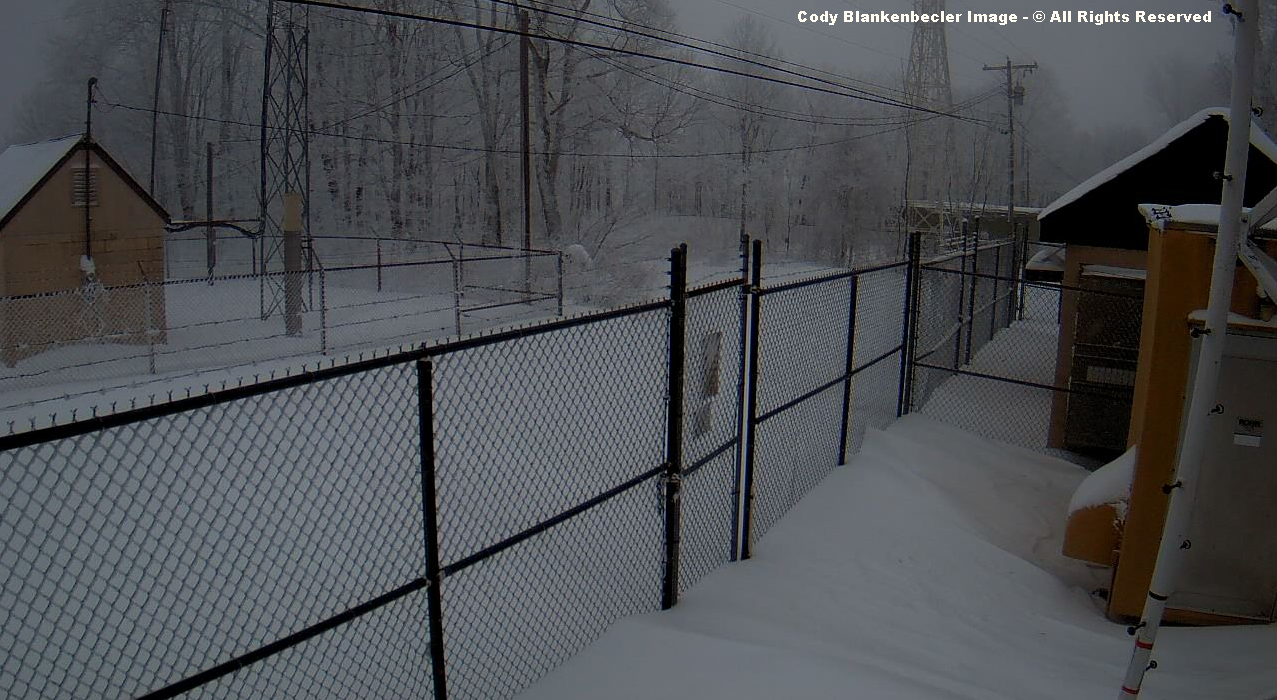
High Knob Massif Webcam – University Of Virginia’s College At Wise
Upslope snow has been steady, and locally heavy at times, throughout the daylight hours of Saturday.
High Knob Massif Webcam – University Of Virginia’s College At Wise
My update this afternoon is not to change anything with the forecast, but rather to highlight what has been observed.
High Knob Massif Webcam – University Of Virginia’s College At Wise
The City of Norton Water Plant had officially measured 18.1″ of snowfall as of 3:00 PM ( and it was still snowing ).
High Knob Massif Webcam – University Of Virginia’s College At Wise
In specific, the fine measurements taken at the City of Norton Water Plant by Superintendent Andrew Greear and his staff ( Caleb Ramsey and Wes Ward during this event ) should be highlighted to illustrate the proper way to measure snowfall during any storm event.
City of Norton Water Plant Elevation 2342 feet
January 22 at 9:00 AM 4.0″
January 22 at 4:00 PM 1.8″
January 22 at 9:45 PM 6.0″
January 23 at 3:40 AM 2.0″
January 23 at 9:00 AM 2.8″
January 23 at 3:00 PM 1.5″
January 23 at 9:30 PM 1.0″
Snowfall Total: 19.1″
The 2-day water equivalent total ending at 9:00 AM today was 2.26″ ( not counting what has fallen since then ).
*The only measurement that had to be partially estimated was the first one due to a tremendous amount of SLEET which tended to bounce off of the measuring surface. After each measurement the surface is swept clean and made ready to collect what falls until the next 6-hour measurement.
Measuring every 6-hours ( or as close to that as possible ) is ideal for helping to minimize compression which occurs as snow accumulates.
Note that if snow falls and sticks, then melts and/or gets blown away in between the measurement times then it should be added to the total ( if not directly measured, then carefully estimated ).
Eagle Knob of High Knob Massif ( 1 to 3 Feet Visible Snow Depth )
*As always occurs on High Knob in big storms like this, ground depths tend to vary from wind blown bare ground ( or near bare ) to 4-5+ feet in drifts.
A preliminary estimate of total snowfall for Eagle Knob of the High Knob Massif is 26.0″ ( up to 3:00 PM on Saturday ). A general 1-3 feet of depth is visible in the above image.
The hardest hit corridor was, as expected, between Bowman Mountain and Thunderstuck Knob of Powell Mountain, with resident Gregory Adams of the Little Mountain community reporting around 2 feet of snow depth at his home.
Cody Blankenbecler measured a settled snow depth of 14″ in Wise, with Andrew Greear & family measuring 15″ of depth at his home on Guest River above Norton.
As of 5:40 PM my official snowfall total for Clintwood had reached 11.0″ with steady, light snow still falling.
My Overnight Discussion
Reference my Afternoon 012216 Forecast Discussion section for more details on the period of heavy morning snow, sleet-ice.
Some of the most intense snow of this storm event, along with the coldest temps-wind chills observed, developed over the High Knob Massif into portions of Norton-Wise during Friday evening beneath the upper low & northerly upslope.
European Model 500 MB Analysis At 7 PM Friday – January 22, 2016
The center of the closing upper low was very close to the area, with Doppler suggesting a circulation right over the High Knob Massif.
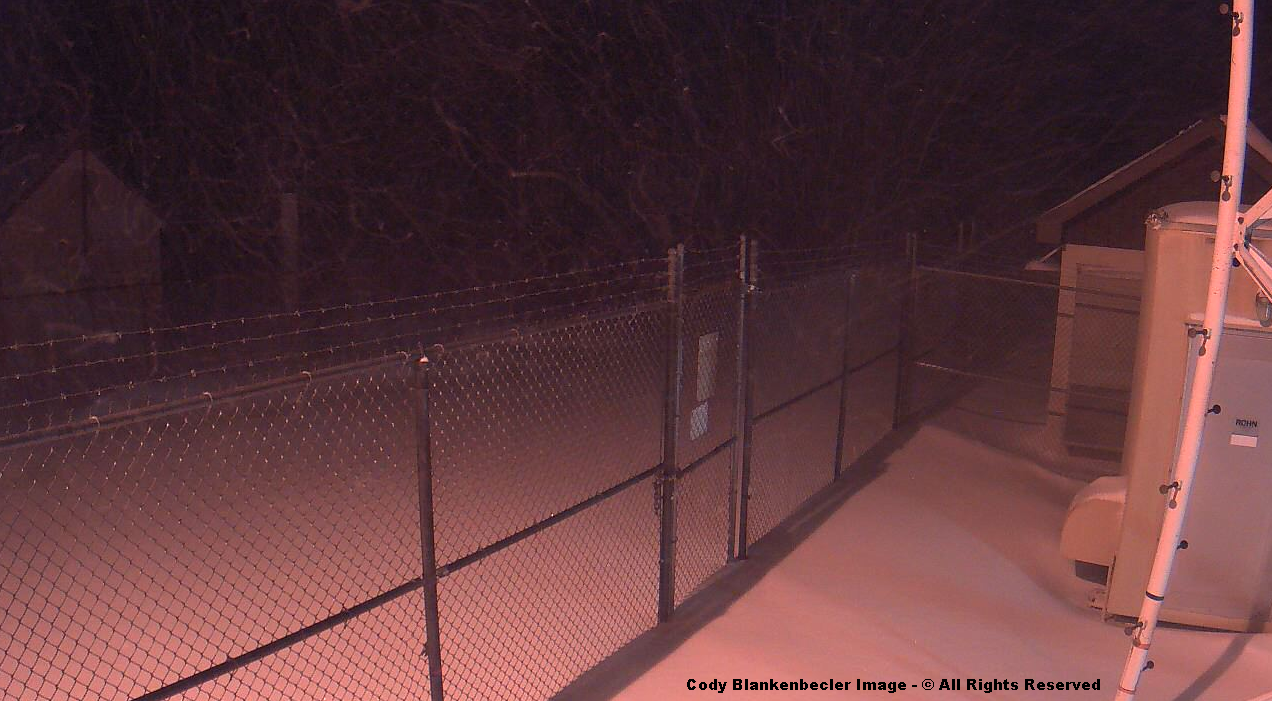
Eagle Knob of High Knob Massif ( 1-2 Feet of Wind Blown Snow ) at 9 PM Friday
Wes Ward of the City of Norton Water Plant measured 6″ of new snow at 9:45 PM ( it accumulated since 4 PM, but mostly after sunset ). This brought the ground depth to around 14″ with a 11.0″ storm snowfall total at the Water Plant.
*The Norton Water Plant had 1.60″ of water equivalent precip for the 24-hour period ending at 9 AM ( accumulated from 2-9 AM ), with only 3″ of new snow as enough warming with sinking air along the High Knob Massif changed snow into sleet along the mixed ( milder ) side of the TIM Circulation. Most precipitation between Bowman Mountain & Big Cherry Lake fell as snow along the colder, upslope side of this mesoscale circulation.
High Knob Massif Webcam – University Of Virginia’s College At Wise
Snow has also gotten deep at UVA-Wise. Check out the car which is nearly buried by snow ( the car has been parked there for this entire event so far ) in this view ( below ).
Benches along the walk-way are now completely buried, with another unknown object ( is it too a car? ) appearing to be buried out at the entrance to the college along the main highway. That may just be a big pile of snow which was pushed off the road.
High Knob Massif Webcam – University Of Virginia’s College At Wise
Focus now is all about upslope snow on northerly flow that will be increasing today as the pressure gradient between this area and the intensifying Atlantic Low strengthens.
European Model 850 MB Wind Analysis At 7 PM Friday – January 22, 2016
The flow has just begun to turn northerly, with a deep northerly flow predicted to develop overnight into today.
NAM Model Forecast Sounding Above Wise At 7 AM Saturday – January 23, 2016
Observe wind vectors on the far right side above, and how the northerly flow extends upward through the atmosphere to the jet stream level around 300 MB. Also note deep moisture present as the solid blue temperature line, and dashed blue dewpoint line, remain nearly together to around 500 MB.
Such a setting certainly supports upslope snow, heavy at times, into Saturday with a transition to more hit-miss snow showers by later Saturday into Saturday Night.
European Model 850 MB Temp & Surface Analysis At 7 PM Friday
The increasing gradient along the mountains will not only be increasing higher elevation winds but also increasing orographic forcing. Thus I expect significant snow is not yet over for upslope locations overnight into Saturday.
New snowfall will generally be much lighter for locations downslope of the mountains, with respect to NW-N air flow, toward the Great Valley & Clinch-Powell-Holston rivers.