**A Major Winter Storm Will Impact The Area From Sunday Into Tuesday With Significant Snow & Possible Mixed Precipitation Types. Scroll Down For Details.
The Bottom Line – A Major Winter Storm will begin impacting the mountain region Sunday. Snow is likely to develop into the mid-day to early PM and continue Sunday Night, with hazardous conditions across the region due to bitterly cold temperatures expected into Sunday Morning.
The amount of total snowfall remains uncertain, but 4″ or more looks likely Sunday PM-Sunday Night as snow density initially begins low. Stay tuned for updates on this developing winter storm setting.
My Previous ALERT
ALERT For Heavy Snow Squalls In Upslope Locations Tonight Into Saturday AM. Extremely Bad Conditions Are Expected To Develop Overnight As Temperatures Drop – Dangerous Cold Will Be In Place Through Saturday & Sunday Morning.
A band or broken line of intense snow squalls will impact the upslope side of the mountain area during the early to mid overnight period with near zero visibility in heavier squalls and hazardous road conditions. Hit-miss squalls will continue to be possible into today.
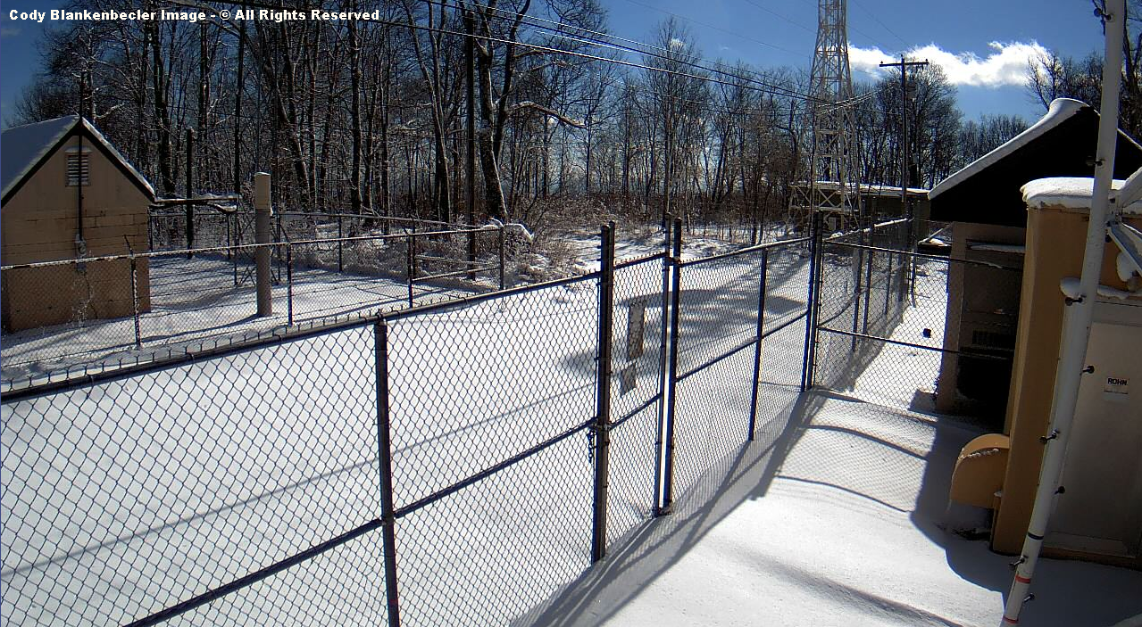
Updated: The Arctic Front snow arrived around 3 AM and produced 45 minutes of heavy-light snow at UVA-Wise and more than 1-hour of driving snow on High Knob ( where it was a horizontal-wind blown fall of snow ). The lee side of a roof top gained more than 4″ between 8:12 PM and 4:27 AM, with numerous snow showers and wind driven squalls.
High Knob Massif Webcam – The Arctic Front Snow Band
Some roads in the high country of the High Knob Massif may become impassible due to blowing & drifting snow into today.
Overnight Into Saturday Morning
Snow showers & squalls. Whiteout conditions at times in squalls ( with hit-miss coverage ). Winds NW-NNW at 10-20 mph, with higher gusts, along middle elevation mountain ridges & plateaus. Winds NW 15-25 mph, with higher gusts, along upper elevation mountain ridges. Becoming bitterly cold by morning. Temperatures varying from 0 degrees at summit levels of the High Knob Massif to lower 10s ( single digits to 10 degrees in Norton-Wise ). Wind chills from 0 to -10 degrees below zero on middle elevation mountain ridges and plateaus, with -10 to -30 degree below zero chill factors in upper elevations above 3000 feet. Blowing-drifting snow along upper elevation ridges.
This Afternoon
A continued chance for flurries. Bitterly cold. NW-NNW winds 10 to 20 mph, with higher gusts, along mid-upper elevation ridges-plateaus. Temperatures varying from single digits at highest elevations in the High Knob Massif to middle to upper 10s, milder lee of the mountains toward the Tri-Cities. Wind chills varying from 0 to -20 below zero in upper elevations to 5 above to -10 below zero along middle elevation ridges.
Tonight Into Sunday Morning
Increasing mid-high clouds. NW-N winds decreasing and shifting easterly into morning. MIN temperatures 0 to 10 degrees ( colder if skies can clear completely for a period of time in places with snow cover ).
Weather Discussion ( February 12-13 )
My Afternoon Update
My update this afternoon features a look at the current forecast, snowfall during the past 24-hours, and what will the next winter storm bring? No rest for the weary!
High Knob Massif Webcam – University Of Virginia’s College At Wise
The only update to my previous forecast is to remove all but flurries, as a few continue northeast of Clintwood, and to raise the PM temperature ever so slightly.
Nora 4 SSE – National Weather Service Site In Middle Elevations
True air temperatures, via official thermometers protected from snow glare, paved surfaces etc…will have a chance to reach into upper 10s for some along the upslope side of the mountains ( I had low-mid 10s ). Lower elevation valleys will possibly crack 20 degrees ( a heat wave ), with milder conditions south of the mountains toward the Tri-Cities.
Black Mountain MesoNET – Observation Up To 1:15 PM Saturday ( Feb 13 )
Highest elevations, especially those above deep snow and on north slopes in the High Knob Massif, will remain in single digits for the entire day ( despite sunshine ).
Eagle Knob of High Knob Massif at 2:23 PM on Saturday ( February 13, 2016 )
Snow glare over a general foot of snow atop the High Knob Massif, with large variations in depth from a wicked overnight period.
A general 2″ to 5″ of snow fell along the upslope side of the mountains during the past 24-hours, coming in at the bottom of my forecast range when including my spread potential which was listed in the forecast.
City of Norton Water Plant
February 12 at 3:00 PM 0.5″
February 12 at 9:00 PM Trace
February 12 at 3:00 AM 1.0″
February 12 at 9:00 AM 1.3″
Snowfall Total: 2.8″
( 6″ Mean Snow Depth )
Snowfall measurements courtesy of Joe Carter & Wes Ward.
*The 3:00 AM total that fell in the Arctic Front snowband had to be partially estimated due to wind blowing the snow off snowboards.
Wes Ward measured 6″ of mean snow depth at the City of Norton Water Plant before sunrise, counting old snow, with Joe Carter measuring 1.3″ of new snowfall between 3 AM and 9 AM as snow showers and local squalls continued.
Snow In High Chaparral of High Knob Massif at 9 AM Saturday – February 13, 2016
My friend Darlene Fields sends out a postcard view of the morning in High Chaparral of the High Knob Massif, with 3.5″ of new snowfall adding to old snow, as some is still falling when this photograph was taken at 9:00 AM.
New snowfall reached at least 5″ up at the summit level of the High Knob Massif, if not a little more, with wicked overnight conditions amid snow, blowing snow, and brutal wind chills. Snowfall with the Clipper reached only 0.5″, so nearly all new snow came via NW Upslope Flow last night into this morning.
On the downslope side of the mountains, with respect to NW Flow, it was a different story with 1.5″ in Jonesville coming almost entirely with the Clipper.
Anna Hess reported much the same in The Pines of the Clinch River Valley, near Dungannon, where 0.8″ of snow fell ( a mere 0.2″ during the NW Flow period as moisture robbing along windward slopes of the massif stole it! ).
Major Winter Storm
These are from 7 AM Model Runs.
Turning focus toward the next major winter storm finds that models today are in rather amazing agreement with respect to total precipitation & axis of heaviest amounts.
I am not allowed to show the European Model, but it has a general 1.50″ to 2.10″ of total precipitation along and west of the High Knob Landform corridor ( similar to the NAM below but somewhat heavier in total amounts ).
NAM 12 KM Model Total Precipitation Forecast – Next 84 Hours
The NAM Model group shows an axis of heaviest precip along the western side of the southern Appalachians.
NAM 4 KM Model Total Precipitation Forecast – Next 60 Hours
This event is not yet fully in view of the high resolution NAM, but the trends in precipitation distribution are clear.
GFS Model Total Precipitation Forecast – Next 96 Hours
The GFS Model has an axis of the heaviest precipitation amounts along the High Knob Landform corridor and the Cumberland Plateau of middle-eastern Tennessee.
GGEM Model Total Precipitation Forecast – Next 96 Hours
The Canadian Model ( GGEM ) is very similar, again with an axis of heaviest precip along the Cumberland Mountains and adjoining Cumberland Plateau ( above ).
JMA Model Total Precipitation Forecast – Next 96 Hours
The JMA Model ( Global Japanese ) also picks up on this same axis with SW-NE orientation in the southern Appalachians.
FIM9 14 KM Model Total Precipitation Forecast – Next 96 Hours
The Flow-following Finite-volume Icosahedral Model, called FIM9 for short ( which divides grids up using polyhedrons into mostly hexagons and 12 pentagons for the globe ) again shows this same type of SW-NE axis of heaviest precip along western slopes of the southern Appalachians.
In summary, as good of agreement as one ever sees from a set of models run for the same time ( 7 AM Run Saturday, February 13, 2016 ). Actually, impressive.
As regards precipitation type, it is not as simple.
Model Snowfall Forecast’s From 12z Run
The European Model, which I am not allowed to show, predicts 6″ at the Wise gridpoint with up to 8″ in the area.
NAM 12 KM Model Total Snowfall Forecast – Next 84 Hours
The NAM Model group is more varied, with 2.9″ to 5.3″ at the Wise gridpoint and locally up to 10″ on the NAM 4 KM ( but it does not extend through the entire event ).
NAM 4 KM Model Total Snowfall Forecast
The GFS Model ( below ) has 3.5″ at the Wise gridpoint with a MAX toward the southwest that goes up to more than 8″ .
GFS Model Total Snowfall Forecast – Next 96 Hours
The Canadian Model ( GGEM below ) predicts 5.1″ at the Wise gridpoint with a MAX also indicated toward the southwest.
GGEM Model Total Snowfall Forecast – Next 96 Hours
The JMA ( Japanese ) snowfall forecast is not available.
FIM9 14 KM Model Total Snowfall Forecast – Next 96 Hours
The FIM9 14 KM Model shows again a snowfall max toward the southwest from Wise, centered across the High Knob Landform corridor.
Initial Thoughts: A heavy precipitation event is coming from Sunday through Monday, with the amount of snowfall being the biggest unknown.
It is clear that all precipitation will begin as snow and continue that way through Sunday into early hours of Monday. Since this is being driven by strong SW flow amid an “open wave” type of setting, it is worrisome since past climatology shows tendency for orographic enhancement along the High Knob Landform sector. This actually seems to be picked up on by some of the models during these morning runs shown above.
Although the flow is not deeply SW, evaporative cooling amid a retreating arctic air mass is going to play a role in the temperature structure of this system. If strong low level inversional conditions form, then strong SW winds can flow above with more limited vertical mixing ( that could keep low-levels colder during much of the event ).
Since models such as the NAM show only limited warming above 850 MB it becomes problematic and could easily trend toward more of the precipitation falling as snow, especially amid the sector where SW air flow rises upward through the High Knob Landform corridor.
I will issue a preliminary snowfall forecast tonight.
The Bottom Line – A Major Winter Storm will begin impacting the mountain region Sunday. Snow is likely to develop into the mid-day to early PM and continue Sunday Night, with hazardous conditions across the region due to bitterly cold temperatures expected into Sunday Morning.
The amount of total snowfall remains uncertain, but 4″ or more looks likely Sunday PM-Sunday Night as snow density initially begins low. Stay tuned for updates on this developing winter storm setting.
Snow showers started increasing during the evening and have been intermixed with squalls in a hit-miss fashion for any given location. Low visibility has occurred in squalls.
High Knob Massif Webcam – University Of Virginia’s College At Wise
Squalls along the actual Arctic Front at 850 MB, which has been followed through the previous evening, are now just northwest of Wise County and will deliver some intense snowfall to places where they strike.
JKL Doppler Radar at 2:13 AM on Saturday ( February 13, 2016 )
Snowfall amounts are going to vary significantly across the area in this type of pattern, even though all locations along the upslope side of the mountains will have accumulation.
NAM 4 KM Model 850 MB Temps-Wind Streamlines at 7 PM Friday
The increase in snow showers and squalls can clearly be seen via the connection to Lake Michigan, with limited activity at 7 PM ( above ) as the flow was passing north of southwest Virginia, then a dramatic increase along the upslope side of the mountains during the evening as the flow turned southward off Lake Michigan ( below ).
NAM 4 KM Model 850 MB Temps-Wind Streamline Forecast – 1 AM Saturday
Squalls up to 1:30 AM have tended to hit repeatedly in some places with 1.5-2″ here at my station in Clintwood. This may even out by morning, and if not then large differences in snow amounts will certainly occur over relatively short distances.
Black Mountain MesoNET Up – Midnight to 1:30 AM Saturday ( February 13 )
Temperatures are dropping with bitterly cold conditions along mid-upper elevation ridges already, well ahead of the coldest air that is still upstream of the mountains ( a plunge to come shortly after passage of the 850 MB Arctic Front ).
A Major Winter Storm is on tap for the mountain area beginning late Sunday and lasting into early Tuesday. Details, are yet to be worked out; although, precip is looking to be very significant. Figuring out how much falls as snow, frozen, rain is impossible at this point. Lets hope the next 24-hours will bring more model agreement on storm track, intensity, amounts.
The JMA ( Japanese ) Model and Canadian Model have it as all snow, while the NAM, GFS, and European show significant snow to rain before a change back to snow. But they differ significantly in the important details, such as track, which would greatly help if known for certain via past climatology of such storm tracks.