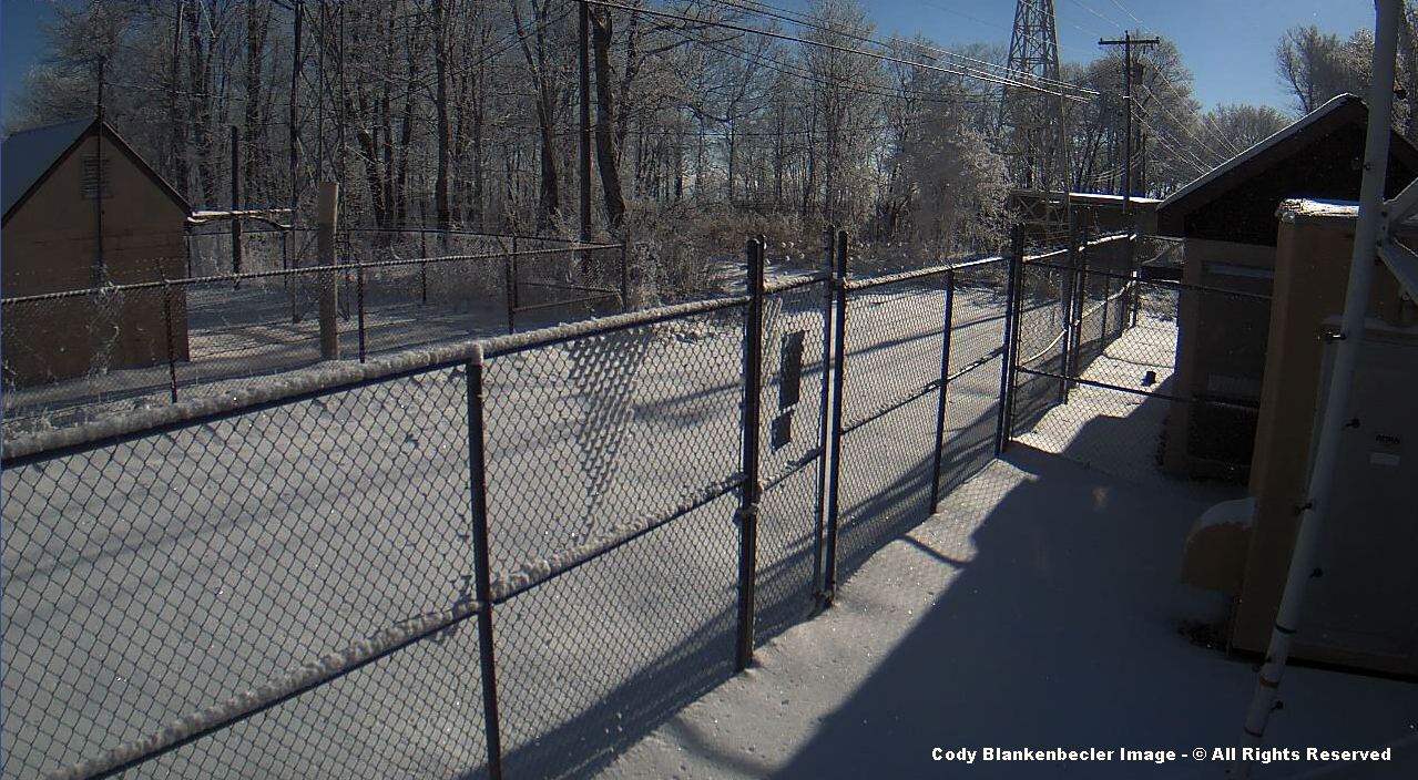
ALERT For Strong SW Winds Developing Late Tonight Into Tuesday With 30 to 50+ MPH Gusts Along Middle To Upper Elevation Mountain Ridges-Plateaus ( the highest wind gusts generally in upper elevations ).
A strengthening pressure gradient will develop overnight into Tuesday morning as another clipper system passes across the Great Lakes. Blowing snow could be a factor for high elevation routes such as State Route 619, 238, 237, 160 as well as others, passing through upper elevations of the High Knob Massif and across the Virginia-Kentucky border on Black Mountain. The strongest low-level jet of roaring wind is expected to pass, with speeds diminishing somewhat, after 10:00 AM to Noon Tuesday. Gusty conditions will continue through Tuesday Night at high elevations. Caution is advised.
Overnight Into Tuesday Morning
Partly cloudy. Becoming windy. SW winds increasing to 15-25 mph, with higher gusts, along mountain ridges-plateaus below 2700 feet. SW winds 20-30 mph, with higher gusts, along mountain ridges above 2700 feet. Blowing snow at high elevations in the High Knob Massif. Temperatures in the 20s to around 30 degrees, tending to rise into morning. Wind chills in the single digits & 10s, rising into the 10s and 20s toward morning.
Tuesday Afternoon
Partly-mostly cloudy ( mid-high clouds ). Windy. SW-WSW winds 10-25 mph, with higher gusts. Temperatures varying from upper 30s to lower 40s at highest elevations to lower-middle 50s ( warmest in downslope locations from Pound to Clintwood and Haysi-Grundy ). Wind chills in the 20s and 30s ( coldest at highest elevations ).
Tuesday Night Into Wednesday Morning
Partly to mostly cloudy. W-NW winds 5-15 mph, with higher gusts, along mid-upper elevation mountain ridges. Temperatures varying from upper 10s to lower 20s in the coldest valleys to the middle-upper 30s. Wind chills in the 20s and 30s along exposed mid-upper elevation ridges.
Wednesday Afternoon-Early Evening
Partly to mostly cloudy. Variable winds generally less than 10 mph. Small chance of a rain shower or a high elevation snow shower by the late afternoon or early evening. Temps varying from upper 30s to lower 40s in upper elevations to the upper 40s to lower 50s.
Wednesday Night Into Thursday Morning
Partly-mostly cloudy. Winds NW-N at 5-10 mph, with higher gusts, along middle-upper elevation mountain ridges. Temperatures varying from low-mid 20s to the lower-middle 30s. Wind chills dropping into the 10s on upper elevation ridges overnight into morning.
A progressively colder pattern Thursday into this weekend, with temperatures near to somewhat below average for this time of year, is being monitored ahead of a developing wave in the flow field. A chance of frozen precipitation types will become possible by late Saturday into Superbowl Sunday. Stay tuned for later updates.
Development of a major storm system is currently being outlooked for the February 7-9 period. Strong winds and a significant temp spike & plunge will be possible with this storm system, along with moderate-heavy precipitation. Stay tuned for later changes.
Weather Discussion ( Windy )
A majestic sunset in wake of the snow will now give way to increasing wind into Tuesday. As so often is the case at this time of year, this will take the edge off warming at middle to upper elevations, especially, and across all locations in the Cumberland Mountains where winds are strong.
High Knob Massif Webcam – University Of Virginia’s College At Wise
Although temperatures climb some Tuesday-Wednesday, they will drop back Thursday into this weekend to produce a seasonally chilly pattern through the next week. A couple of potentially important systems are upcoming during the next 5-10 days, but details remain to be worked out.
Preliminary Snowfall Report ( January 29-30 System )
Half A Foot of Snow Depth In High Chaparral of High Knob Massif – January 30, 2017
UVA-Wise NWS: 1.6″ ( 2″ ground )
The Pines In Dungannon: 2.7″ ( 2″ ground )
Clintwood 1 W: 2.8″ ( 0.16″ NWS Rain Gauge )
Nora 4 SSE: 3.2″ ( 0.19″ NWS Rain Gauge )
City of Norton WP: 4.0″ ( 0.28″ NWS Rain Gauge / 3.0-3.5″ ground )
Head of Powell Valley: 4.5″ ( 4″ ground )
High Chaparral of High Knob Massif: 6.5″ ( 6″ ground )
Eagle Knob of High Knob Massif: 8.5″ ( variable wind blown depths )
*Totals ideally include that which stuck-melted and/or settled during the event; although, all totals may not fully reflect this aspect which naturally creates variability in ground depths. The addition of strong winds, like experienced at high elevations in the High Knob Massif, being a major factor in depth variations.
Wicked Conditions On Eagle Knob of High Knob Massif – January 30, 2017
Conditions were simply wicked within upper elevations of the High Knob Massif with prolonged, persistently heavy snow during the overnight period.
Sample Hour From Black Mountain Mesonet At 4031 Feet Above MSL
*Air temperatures in the low-mid 10s combined with wind gusts of 30+ mph to generate below zero wind chills, with snow & blowing snow causing low visibility and large snow depth variations.
Snow Along U.S. 160 On Black Mountain Near The Wise-Harlan Border
While upslope snowfall was key, a snowstreak that was long-lived extended from Black Mountain to the Head of Powell Valley and across the main crest zone of the High Knob Massif ( 6″ to 12″+ of ground depth was common by Monday morning from High Chaparral to the peak area of High Knob, varying from near bare ground in places to a couple feet or more in wind blown drifts ).
Ground Depth Measured In High Chaparral By Darlene Fields – January 30, 2017
Joe & Darlene Fields have been measuring winter snowfall in the High Chaparral community of the High Knob Massif for more than 24 years ( elevation 3300 feet above mean sea level ).
Sharon Daniels verified that with around 4″ of snow at her lovely home sitting around 1850 feet above sea level in the Head of Powell Valley ( nearly 2400 vertical feet lower in elevation than the top of the massif ).
*The 8.5″ snowfall total for Eagle Knob is a best estimate, with the heaviest snow amounts across the head of Big Cherry Lake Basin which includes the peak of High Knob.
NASA Visible Image on January 30, 2017
While snow cover was widespread ( solid ) in nature from the High Knob Massif-Tennessee Valley Divide ( the white line I have on the above NASA Visible Image ) northwest to north, amounts varied with embedded squalls and streaks of snow squalls ( snowstreaks ) from 1-2″ on the low end upwards to 6-8″+ on the high end.
To the south and southeast of the solid white line, or the Tennessee Valley Divide & High Knob Massif, the snow was patchy in nature and dominated by bursts of snow in the squalls supported by very cold air aloft. Here totals varied from a dusting to 1-2″ at most as this area lacked upslope and had to rely on atmospheric dynamics.
NASA Visible Image on January 30, 2017
Looking at this from a larger-scale perspective, streaks of snow can be seen across Kentucky to the northwest of the mountains amid otherwise bare ground, as once again with a lack of orographic lift snow accumulations were yet again relegated mostly to atmospheric dynamics ( cold air aloft & DPVA or Differential Positive Vorticity Advection which supported rising air and local streaks of snow ).
NASA Visible Image on January 30, 2017
*Many lingering clouds prevented this from being an ideal view, but a couple solid bands of snow cover can be seen along the two fronts of the Appalachians…the Cumberland-Allegheny toward the northwest and the Blue Ridge toward the southeast. Initial lifting and convergence of air along the Cumberland-Allegheny ranges often making up for their lower elevation versus the Blue Ridge which both MODELS and most FORECASTERS neglect.
ALERT For The Development Of Accumulating Snow And Hazardous Travel Conditions During Sunday Into Monday Morning ( January 29-30 )
Monday AM Update At 2:45 AM – Another area of heavy snow is beginning to move into Wise County from the west and will overspread the Norton-Wise and U.S. 23 corridor through 3:00 to 3:30 AM. Blowing snow will add to the reduction in visibility which is expected to be near zero at times. Another band of snow will be moving into portions of northern Dickenson and Buchanan counties.
*A persistent streak of snow has dropped significant amounts from Black Mountain into portions of the High Knob Massif since Midnight. Expect difficult travel conditions in upper elevations, with travel not recommended. Drifting snow is occurring.
A region of very cold air aloft will trigger flurries, snow showers and bursts of heavy snow in squalls and streaks of heavy snowfall during Sunday into Monday morning. While the greatest amounts of snow are generally expected along the windward ( SW to NW ) sides of the Cumberland and Blue Ridge mountain ranges, locally heavy snow may also occur in portions of the Clinch, Powell, and Holston valleys. The worst driving conditions are anticipated from late Sunday afternoon into early Monday with widespread hazardous travel developing along the usplope side of the mountains ( where SW to NW air flow rises ).
Expect rapidly changing weather and low visibility, with near whiteout conditions, in the more intense squalls and streaks of snow during Sunday PM into Sunday Night. Caution is advised.
**An ALERT For ROARING SW Winds Will Likely Be Needed For Monday Night Into Tuesday.
Overnight Into Sunday Morning
Periods of flurries & snow showers. Little accumulation. Winds SW-WNW at 5-15 mph, with higher gusts. Temps dropping into the 20s to lower 30s. Wind chills in the 10s and 20s ( coldest on upper elevation mountain ridges ).
The best coverage of snow showers and heavier squalls is expected to generally be along and southwest of the High Knob Massif and Tennessee Valley Divide during much of Sunday, from the Wise & Sandy Ridge plateaus southwest along the Virginia-Kentucky stateline on SSW-WSW flow. Coverage of activity is expected to increase as instability increases into mid-day to early afternoon.
Downsloping and somewhat milder temps is expected to produce less snow accumulation toward Pound, Clintwood, and in adjacent communities across northern Wise and much of Dickenson County prior to a late afternoon wind shift.
Sunday Afternoon
Snow showers, flurries and snow squalls-streaks of heavy snow. Heaviest snow amounts along and southwest of the Tennessee Valley Divide and High Knob Massif. Winds SSW-WSW at 5-15 mph, with higher gusts, shifting W-WNW late. Temperatures in the 20s to low-mid 30s. Wind chills in the 10s and 20s.
A wind shift to W-WNW by late Sunday afternoon into Sunday evening is expected to change the focus for heavier snowfall amounts toward locations along and west to northwest of the High Knob Massif & Tennessee Valley Divide on W-WNW flow.
Due to very cold air aloft, any location will be at risk for a burst of heavy snow; although, best coverage is expected where air flow is forced to rise on SW to NW trajectories.
Sunday Night Into Monday Morning
Snow showers, flurries, and snow squalls-streaks of heavy snow taping to flurries and localized snow showers toward morning. Winds W to NW at 10-20 mph, with higher gusts. Temperatures varying from around 10 degrees at highest elevations to the upper 10s to lower 20s. Wind chills in the single digits and 10s, except below zero in upper elevations.
Snowfall Forecast – Sunday Into Monday Morning
A general 2″ to 6″ is expected, with a target snowfall of 4″ in the Norton-Wise area ( +/- 2″ error potential ). Locally higher amounts will be possible at upper elevations in the High Knob Massif. Snow depths are expected to be less than total snowfall at lower-middle elevations, where some melting will occur during Sunday. Snow to water ratios are expected to be greater than 10:1 ( snow density low ), especially by later Sunday into Sunday Night due to bitterly cold air aloft and a relatively deep dendritic crystal growth zone within the vertical ( i.e., moisture intersecting bitter cold air ).
Monday Afternoon
Partly cloudy. Cold. WNW-WSW winds 5-10 mph, with higher gusts. Temperatures varying from the mid-upper 10s to the mid-upper 20s to lower 30s ( coldest in upper elevations ).
Monday Night Into Tuesday Morning
Variable clouds. Becoming windy, especially at middle to upper elevations. Temps in the 10s and 20s, then rising into the overnight-morning ( especially on mid-upper elevation mountain ridges ). SSW-WSW winds increasing to 15-25+ mph, with higher gusts. Wind chill values in the single digits and 10s, then rising values into morning.
Weather Discussion ( Bursts Of Snow )
Widespread snow will be impacting the mountain area on Sunday into early hours of Monday, with worst conditions developing by later Sunday into Sunday Night.
NAM 12 KM Model 700 MB RH & Vertical Motion Forecast At 1:00 PM Sunday
Abundant moisture and rising air during Sunday PM into Sunday Night will combine with cold air aloft to produce widespread snow and bursts of heavy snow.
NAM 12 KM Model 700 MB RH & Vertical Motion Forecast At 7:00 PM Sunday
There is no doubt that snow will be widespread, but amounts will vary significantly due to a combination of factors between the surface and middle troposphere ( i.e., 700-500 MB layer ).
NAM 4 KM Model 80M Wind Speed-Direction At 1:00 PM Sunday
While I expect the worst conditions to develop around and after a wind shift occurs between 1:00 PM and 7:00 PM on Sunday, there will likely be notable differences in weather conditions prior to that time with SSW-WSW flow favoring the heavier snowfall and accumulations to occur in locales where this air flow rises ( from the Sandy Ridge and Wise plateaus southwest to Norton, Powell Valley-Big Stone Gap into portions of Lee County ) versus where it sinks ( from Pound-Clintwood toward Haysi and Grundy ).
*This will be partly due to the cooling that occurs with rising air that will help keep surface temperatures lower within the lifting zone versus where this air flow sinks. The strongest cooling and best accumulations, of course, being most favored across upper elevations in the High Knob Massif and the Black mountains.
NAM 4 KM Model 80M Wind Speed-Direction At 7:00 PM Sunday
Forecast soundings show a deep saturated layer with a steep temperature decline late Sunday into Sunday Night to support development of widespread snow, abundant bursts of snow and hazardous driving conditions. So regardless of what happens prior to sunset on Sunday, I expect upslope locations ( with respect to W-WNW air flow ) to have the worst conditions form during this time.
*This is a classic sounding profile that past climatology shows tends to be very productive. The main missing ingredient to keep this going and enhance it further is a lack of deep connection to the Great Lakes ( a notable missing ingredient so far during the 2016-17 Winter Season across the southern Appalachians…if this was present I would be going significantly higher on my forecast snowfall numbers ).
NAM 12 KM Model Forecast Sounding At 10:00 PM Sunday – January 29, 2017
The Bottom Line
Widespread snow is expected Sunday into Monday AM, with an initial focus of most numerous snow showers, squalls and snowstreaks being biased toward locales where SSW-WSW air flow rises ( e.g., Wise southwest toward Big Stone Gap ) prior to a wind shift timed to occur by late afternoon Sunday.
A wind shift toward W-WNW will tend to shift the focus for most widespread snow showers, squalls and snowstreaks to locations along and west to northwest of the High Knob Massif and Tennessee Valley Divide during Sunday Night into early hours of Monday.
*Max accumulations during this event occurring where these two zones overlap, ideally, across the High Knob Massif and along the Tennessee Valley Divide. Cold air aloft ( as noted below ) could locally skew this and allow for significant amounts in places outside of this orographic overlap zone via bursts of snow.
Due to very cold air aloft, and relatively deep moisture intersecting a zone prime for dendritic crystal growth, I expect bursts of intense snow to generate whiteout type of conditions ( i.e., low visibility ) at times. This puts any location at risk for a burst or bursts of snow.
The worst travel conditions are expected to develop on a widespread basis by late Sunday into Sunday night.
I expect widespread school closings and delays for counties within the mountains on Monday.
A Much Colder Weather Pattern Will Dominate The Mountain Region During The January 26-30 Period. Several Waves Will Bring Flurries & Snow Showers, With The Most Significant Potential Developing By This Weekend ( January 29 ).
*Although some slick travel could develop into morning hours of Friday & Saturday, the most significant and widespread impact is expected during January 29-30 when an Alert For Widespread Hazardous Travel will be likely with moderate-heavy snow.
Overnight Into Wednesday Morning
Mostly clear. Colder. Areas of valley fog in low elevations. Increasing SSW-WSW winds on mid-upper elevation ridges to 10-20 mph, with higher gusts, by morning. Temps from the 20s to lower 30s, rising on exposed mountain ridges and plateaus during the overnight-morning.
Wednesday Afternoon
Partly to mostly sunny, then increasing clouds by late. Windy. SSW-SW winds 15 to 25 mph, with higher gusts. Temperatures varying from upper 40s to low 50s in upper elevations to the upper 50s to low-mid 60s ( warmest in downslope locations from Pound to Grundy ).
Wednesday Night Into Mid-Morning Thursday
Cloudy with evening rain developing. Windy. Brief downpours giving way to overnight showers and drizzle to possible flurries. SW winds shifting W-WNW at 10-25 mph, with higher gusts. Turning colder. Temps dropping into the middle 20s to mid-upper 30s by morning ( coldest at the highest elevations ). Wind chills falling into the 10s & 20s.
Thursday Afternoon
Mostly cloudy. Cold. Chance of flurries. Windy. WSW-WNW winds 10-20 mph, with higher gusts. Temperatures nearly steady or slowly falling in the 30s ( lower-middle elevations ) and 20s ( upper elevations ). Wind chills in the 10s & 20s ( except single digits in gusts at high elevations ).
Thursday Night Into Mid-Morning Friday
Cloudy. Cold. Chance of flurries & snow showers. Light accumulations possible. Winds W-WNW 5-15 mph, with higher gusts. Temperatures varying from the mid-upper 10s to the mid-upper 20s to around 30 degrees ( coldest at highest elevations ). Wind chill factors in the 10s and 20s, except 0 to 10 degrees on upper elevation mountain ridges. Rime formation at highest elevations.
Although some light accumulations, with a dusting to locally 1″+ could occur through Saturday, the heaviest and most widespread snowfall is expected to develop during the January 29-30 period.
Friday Afternoon
Mostly cloudy. Cold. A chance of flurries or snow showers. Winds W-WNW 5-15 mph with higher gusts. Temperatures varying from upper 10s to lower 20s at highest elevations to the upper 20s to lower 30s. Winds chills mostly in the 10s & 20s, with single digits along upper elevation ridges.
Friday Night Into Saturday Morning
Cloudy. Snow showers. Cold. Light accumulations. Winds SW-W 10-20 mph, with higher gusts. Temperatures varying from mid-upper 10s at highest elevations to the mid-upper 20s. Wind chills in the single digits and teens, except sub-zero in stronger gusts at highest elevations.
Heavier snow showers and snow squalls ( bursts of heavy snow ) will be likely during the Sunday into Monday period. An Alert For Hazardous Travel will likely be needed.
Weather Discussion ( Winter Returns )
January-like cold will finally be returning to the mountain landscape by Thursday through this weekend, in wake of a major storm system dominated by rain and strong rises on creeks-streams.
High Knob Massif Webcam – University Of Virginia’s College At Wise
Preliminary Storm Rainfall Totals ( January 23-24 )
City of Norton WP: 1.56″ ( 5.12″ In January )
Nora 4 SSE: 1.67″
Clintwood 1 W: 1.83″
Black Mountain Mesonet: 2.90″ ( 7.05″ In January )
*Widespread 1.50″ to 3.00″ storm rainfall totals were observed along & northwest-north of the High Knob Massif-Black Mountain and Tennessee Valley Divide corridor during January 23-24. Rain mixed with snow fell at summit levels of the High Knob Massif from Monday afternoon into Tuesday AM, but with generally no accumulation ( temps near to just above freezing ).
Snowfall totals of 2-6″+ were reported within upper elevations of central-northern West Virginia ( no accumulations have yet been reported across southern Appalachian peaks ).
Big Stony Creek Stream Levels During January 20-24, 2017
Strong rises occurred on creeks, with Big Stony Creek cresting only 12″ ( 1 foot ) below flood stage following between 2.00″ to 3.00″ of rain at upper elevations in the High Knob Massif.
Guest River Stream Levels
Around 4 to 6 vertical feet of water level rise occurred on larger streams, such as the Guest River and Clinch River.
Clinch River At Speers Ferry
The focus now shifts toward a cold 3-7 day period upcoming.
European 51-Member Ensemble MEAN 500 MB Height Anomalies Forecast
A +PNA ( Pacific North American Oscillation ), which has been very limited in nature this winter season, will be in place to help force an eastern USA upper air trough.
Several embedded disturbances ( waves ) in the flow will drop into the upper trough over the eastern USA to trigger snow showers and flurries through this weekend into early next week.
European 51-Member Ensemble MEAN 850 MB Temp Anomalies Forecast
Colder than average temperatures will dominate the 3-7 day period into early next week. The trend beyond that time is uncertain, with ongoing changes underway amid the high latitudes involved with a displacement of the polar vortex away from the North Pole and warming in the stratosphere. Tropospheric model volatility is expected.
An Alert For Development Of A Major Storm System, With Deep Low Pressure, Is Now In Effect From Late Sunday Into Tuesday Morning.
A powerful low pressure will develop along the Appalachians by late Sunday into Monday. Showers & thunderstorms Sunday will give way to the development of heavy rainfall Sunday Night into Monday, with significant rainfall amounts expected.
Strong rises on streams will be likely into Monday. Folks living & driving through low-lying and flood prone locations will need to remain alert for changing conditions.
An increase in wind speeds and colder air will develop by late Monday into Tuesday, with a change from rain to accumulating snow at elevations above 3500 feet.
Overnight Into Saturday Morning
Mostly cloudy ( high clouds ). Areas of valley fog possible. Winds SSW-SW at 5-15 mph, with higher gusts, on ridges & plateaus below 2700 feet. SSW-SW winds 10-20 mph, with higher gusts, on upper elevation mountain ridges. Temps varying from 30s to around 40 degrees in valleys to the upper 40s to low-mid 50s on gusty mountain ridges.
Saturday Afternoon
Increasing clouds with a chance for showers or steady rain by middle to late afternoon. Unseasonably mild. Light SE-S winds at mostly less than 10 mph. Temperatures varying from upper 40s to lower 50s at highest elevations to the upper 50s to lower 60s.
Saturday Night Into Sunday Morning
Mostly cloudy. Chance of showers. SE-S winds increasing to 5-15 mph, with some higher gusts along mountain ridges by morning. Temperatures in the 40s to lower 50s. Areas of dense valley fog.
Sunday Afternoon
Mostly cloudy. A chance of showers & thundershowers. Mild. ESE-SSE winds at 10-20 mph, with some higher gusts, especially across middle-upper elevation mountain ridges & plateaus. Temperatures from the 40s to lower-middle 50s, coolest at the highest elevations.
Strong water level rises on streams will be possible into Monday. Folks living and driving through low-lying, flood prone locations will need to remain alert to changing conditions.
Sunday Night Into Monday Morning
Rain developing. Becoming windy. Heavy rainfall totals. Winds shifting from easterly to northerly into morning. Wind speeds 10-20 mph, with higher gusts, on mid-upper elevation plateaus-ridges. Dense fog ( orographic clouds ) at mid-upper elevations. Temperatures dropping into the 40s. Wind chills falling into the 30s in upper elevations.
Monday Afternoon
Rain & showers. Low clouds with dense fog at elevations above 2500-3000 feet. Patchy fog at lower elevations. NW-N winds 10-25 mph with higher gusts. Temperatures falling into the 30s to low-mid 40s ( coldest at highest elevations ). Wind chills dropping into the 20s & 30s.
A change from rain to snow is expected in upper elevations by late Monday into Tuesday AM. Accumulations of 1-3″ are expected at elevations above 3500 feet, with 3-6″+ at elevations above 4000 to 5000+ feet in the southern Appalachians. Slushy to hazardous driving conditions are expected at these high elevations.
Monday Night Into Tuesday Morning
Rain & showers. Rain changing to snow at the highest elevations. Winds NW-N at 10-25 mph, with higher gusts. Dense fog at elevations above 2500-3000 feet, becoming freezing fog at elevations above 3400 feet. Temperatures dropping into the upper 20s to mid-upper 30s ( coldest at highest elevations ). Wind chills in the 10s and 20s ( again coldest at highest elevations ).
A storm system tracking across mid-continent will push milder air briefly back into the mountain region by the middle of next week, before temperatures crash during late week to mark the start of a prolonged wave of cold conditions.
Weather Discussion ( Major Storm )
Saturday Night Update
The strongest low pressure of the winter season to date will be impacting the mountain region Sunday into Tuesday AM, with home barometers expected to plunge toward 29.00″ .
Any time pressure has reached that low in the past, strong winds develop as the center begins moving away with rapidly rising air pressures as air flow rushes across the mountains to fill the “void” of low pressure ( i.e., the atmosphere works to achieve balance ).
NAM 12 KM Model 500 MB Forecast To 7:00 PM Monday – January 23, 2017
Although varying at the surface with details, models remain fairly consistent at upper levels. Past climatology says that significant weather impacts will occur with this type of storm development, which will present an array of conditions varying from showers and possible downpours in thunderstorms Sunday to heavy rain Sunday Night into Monday. Winds increase and air turns colder later Monday as barometric pressure begins rising rapidly as the storm center shifts east. Rain turns to accumulating snow at upper elevations ( cold air is limited, so this will be a strongly elevation biased event with respect to snow accumulations ).
NAM 12 KM Model 850 MB Forecast To 7:00 PM Monday – January 23, 2017
Previous Discussion
This is the “quiet” before major storm development occurs by late weekend into early next week over top of the great southern Appalachians.
Sunset From Powell Valley Overlook Along U.S. 23 On January 20, 2017
The energy responsible for this major storm system is just entering the western USA, and will track eastward across the southern states this weekend.
NAM 12 KM Model Initialized 500 MB Vector Wind-Vorticity At 7 PM Friday ( Jan 20 )
Models are in excellent agreement with the wave developing a negatively tilted ( from NW to SE ) upper trough, with strong low pressure development from the surface upward to 500 MB by late Sunday into Monday.
NAM 12 KM Model 500 MB Vector Wind-Vorticity Forecast At 7 AM Monday ( Jan 23 )
A couple of different low pressure centers are currently forecast to give way to rapid development of a deep, strong low center over the southern Appalachians early Monday. It will be important to check back as new model runs come out through the next 24-hours.
NAM Model Surface Winds & Mean Sea Level Pressure Forecast: 7 AM Jan 23
The Friday evening ( 00z ) run of the European Model has a 984 MB ( 29.06″ ) low near the Tri-Cities at 1:00 AM Monday.
Either scenario, by the NAM or European, would create a high impact upon the mountain area with strong winds and heavy to potentially excessive rainfall ( enhanced by orographic forcing along the Cumberland Mountains and TN-NC border area ).
Since the wavelength between major waves is relatively short, only a brief window of opportunity will exist from Monday afternoon into Tuesday morning for a possible transition to snow at mid-upper elevations ( forced by a combination of dynamic + upslope + advective cooling of the vertical column…before warm air advection aloft develops in advance of the next mid-continent system ).
The Bottom Line:
Major Storm Development is expected by late Sunday into Monday with deep low pressure forming over top of the southern Appalachians. Heavy rain and strong water level rises on streams will be possible.
Folks living & driving through flood prone, low-lying areas will need to remain alert to changing conditions. Strong winds will also develop, especially at middle-upper elevations. In addition, a change to wet snow is being monitored for upper elevations by later Monday into early Tuesday ( with snow levels and any possible amounts yet to be determined ).
Several Significant To Major Storm Systems Will Be Impacting The Mountain Region During The Next Five To Ten Days, And Beyond In Time, With A Colder Trend Developing During The January 23-31 Period.
Strong rises on streams will begin to become more of a concern during this stormy pattern. Folks living and driving through low-lying, poor drainage and flood prone locations will need to keep alert of changing weather conditions. Stay tuned for updates.
ALERT For Dense Fog Continues Into Monday Morning
A very moist, saturated atmosphere will support widespread dense fog into Monday morning. Visibility will drop to a quarter mile or less in the more dense areas of fog. Caution is advised.
Overnight Into Mid-Morning Monday
Low clouds with widespread dense fog. A chance for drizzle. Winds SW to W at 5-10 mph, with some higher gusts, along middle-upper elevation mountain ridges. Temperatures widespread in the 40s to around 50 degrees.
Monday Afternoon
Partly cloudy & unseasonably mild. Winds SSW-SW at 5-10 mph, with higher gusts. Temperatures varying from low to mid 50s in upper elevations to the lower-middle 60s.
Monday Night Into Tuesday Morning
Cloudy. Becoming windy with a chance of showers and downpours overnight into morning. Thunder possible. Winds S-SW at 5-15 mph, with higher gusts, on mountain ridges & plateaus below 2700 feet. Winds SW 15-25 mph, with higher gusts, on mountain ridges above 2700 feet. Mild with temperatures in the upper 40s to low-mid 50s. Dense fog redeveloping along upper elevation mountain ridges ( locally in other locations ).
Tuesday Afternoon
Low clouds. Windy. Showers redeveloping, with a chance of thunder ( especially by late ). SW winds 10-20 mph with higher gusts. Dense fog along upper elevation mountain ridges. Temperatures from around 50 degrees at highest elevations in the High Knob Massif to the upper 50s to middle 60s ( warmest in lower elevations ).
Tuesday Night Into Mid-Morning Wednesday
Showers with a chance of thunder. Downpours likely. Gusty SW winds at 10-25 mph, with higher gusts, shifting WNW by morning and decreasing to 5-15 mph. Mild through the overnight then turning colder during morning. Temps widespread in the 50s, then dropping into the 40s and 30s during the predawn to mid-morning period ( coldest at the highest elevations ). Areas of fog with widespread dense fog across the upper elevations. Wind chills developing by morning with values dropping into the 20s and 30s.
Updated: Wednesday Afternoon
Partly to mostly cloudy ( cloudier toward the north and northwest of Wise ). Chilly. Winds WNW-NW at 5-10 mph, with higher gusts. Temperatures varying from upper 30s to around 40 degrees at highest elevations to the mid-upper 40s to around 50 degrees ( warmer southward into valleys of the Clinch, Powell, Holston rivers ).
Wednesday Night Into Thursday Morning
Mostly clear during the evening, then increasing high altitude clouds overnight into morning. Areas of fog possible, especially at lower-middle elevations. A large vertical temperature spread developing between valleys & ridges. Light & variable winds below 2700 feet. Winds SW to WNW at 5-15 mph, with higher gusts, along mountain ridges above 2700 feet. Temperatures varying from low-mid 20s in high valleys to the 30s, except readings rising into 40s on higher elevation ridges by predawn-morning.
The return of a colder, wintry pattern is being monitored for the January 23-31 period. This could begin with a major storm system, featuring high winds and a heavy rainfall to high elevation snow potential. Stay tuned for later updates.
Weather Discussion ( Active Pattern )
Wednesday Morning Update
Low clouds are breaking up along the southeast edge of a large cloud shield, so I have updated my Wednesday PM forecast to account for this current trend.
High Knob Massif Webcam – University Of Virginia’s College At Wise
If this trend continues, afternoon temperatures will be a little milder and sunshine more abundant. A low cloud deck will likely remain very close by, near the Virginia-Kentucky stateline, such that conditions will vary significantly over short distances along the U.S. 23 corridor.
NASA Visible At 9:30 AM on Wednesday – January 18, 2017
Turbulent mixing, enhanced by mountain waves, appears to have been able to mix out a relatively narrow inversion just above the summit level of the High Knob Massif to open up clouds. To the northwest, by notable contrast, where mountain waves are lacking, a solid deck of clouds is continuing to hold.
Monday Evening Update
A stormy weather pattern is upcoming for the mountain region during the next 1-2+ weeks. It is important to begin highlighting this now, as the first wave will start impacting the mountains overnight into Tuesday ( the weakest wave ).
European 51-Member Ensemble MEAN 500 MB Height Anomalies: Days 6-10
The European Ensembles remain very consistent day after day in the upcoming forecast setting, with blocking taking shape near Hudson Bay and a storm train of waves moving across the USA from west to east beneath it.
As I have already noted, many days ago, the combination of Pacific Ocean moisture ( mid-upper levels ) & Gulf of Mexico moisture ( low-levels ) with orographic forcing will make upcoming systems productive precipitation producers. Given all the wetness of the past 7 weeks, an increasing threat for too much water will have to be respected.
As the EPO trends negative by around January 23, it will join a +PNA to help a colder pattern to develop. Until then rain will continue to be the major precipitation form.
Previous Discussion
A very moist atmosphere continues to grip the mountain area with widespread dense fog at middle-upper elevations across Wise and Dickenson counties at the present time.
High Knob Massif Webcam – University Of Virginia’s College At Wise
The lower atmosphere has become saturated through a deep layer.
Lonesome Pine Airport In Wise
Fog has now been dense at high elevations in the High Knob Massif for the past 6 days Only a minor break occurred when the highest elevations got briefly above the low cloud deck. Another break, if lucky, could occur Monday afternoon with partly cloudy skies.
European Model 850 MB Temp Anomalies Analysis At 7 AM Sunday – January 15
An unseasonably warm air mass for this time of year is widespread across the USA and western-central Canada.
NWS 4 KM HRAP Precipitation Estimate – November 28 to January 12
The NWS HRAP Precipitation Estimate is too low for the City of Norton and High Knob Massif area ( above ), where totals during the November 28 to January 12 period have varied from 12.80″ in the City of Norton ( official NWS rain gauge ) to as much as 18.00″ in upper elevations of the High Knob Massif.
This is part of a wet winter season pattern that has produced a general 10.00″ to 15.00″+ of total precipitation in the High Knob Massif area ( including the City of Norton ) since the beginning of December 2016 ( several inches more if including the final couple of days in November ).
European 51-Member MEAN 500 MB Height Anomalies Forecast: Days 6 to 10
Several important weather systems will be impacting the mountain region through the next week to 10 days, with number one upcoming for late Tuesday into Wednesday when gusty showers & possible thunder will give way temporarily to a drop in temperatures.
NAM 4 KM Model Total Rainfall Forecast To 7 AM Wednesday – January 18, 2017
As the wet pattern rolls onward this week, signals for a major-league storm system continue to show up in models for the final week of January ( beginning around the Jan 22-23 period based upon current timing ). This occurs as high latitude blocking develops over Canada with falling 500 MB heights to the south. Confidence in this is increased since major changes are also expected in the stratosphere and polar vortex positioning through the end of January.
A setting like this typically produces a series of storms, so a very active pattern is upcoming into the extended that will feature a notable trend back toward wintry conditions in the final week of January.
ALERT For Dense Fog Development Into Friday AM For Locations Along and N-NE Of The High Knob Massif & Tennessee Valley Divide
A frontal boundary will drop into the Cumberland Mountains and stall, with fluctuations in its position expected throughout the up- coming weekend. Dense fog will tend to be persistent across high elevations, with intervals of dense fog at middle-lower elevations. Intervals of showers will also occur, continuing this wet pattern.
Overnight Into Mid-Morning Friday
Showers developing. Gusty SW winds shifting NNW-NNE by morning at 5-15 mph, with higher gusts. Dense fog possible, especially at mid-upper elevations along and north of the High Knob Massif-Tennessee Valley Divide. Temperatures dropping into the 40s.
Friday Afternoon
Low clouds. Chilly. Chance of drizzle or light showers. Light & variable winds. Temperatures in the upper 30s to middle 40s in locations along and north of the High Knob Massif & Tennessee Valley Divide ( milder to the south ).
Friday Night Into Saturday Morning
Light rain & showers redeveloping. Areas of fog ( dense at high elevations ). Winds shifting SSW to WSW at 5-15 mph, with higher gusts. Temperatures steady or rising into the middle 40s to lower 50s.
Saturday Afternoon
Showers. Gusty. Areas of fog ( dense at high elevations ). SSW-WSW winds 5-15 mph, with higher gusts, below 2700 feet. Winds SW-WSW 10-20 mph, with higher gusts, along upper elevation mountain ridges. Temperatures varying from upper 40s to upper 50s ( coolest highest elevations ).
Saturday Night Into Sunday Morning
Showers. Area of fog ( dense across upper elevations ). SW-W winds 5-15 mph, with higher gusts, possibly shifting N by morning. Temperatures widespread in the 40s to lower 50s.
*A heavy rainfall potential continues to be monitored for next week. Strong rises on streams could occur depending upon rain amounts. Stay tuned for later updates.
**A major pattern change back to cold, wintry conditions is being monitored for the last week of January into the start of February. Chances for a return to a cold, wintry pattern are increasing for the longer-term period.
Weather Discussion ( Wet Pattern )
A frontal boundary will be dropping into the mountains and stalling, with the boundary being south to north of the area throughout the upcoming weekend. This means periods of showers and a predominance of low clouds, with dense fog being persistent and long-lived across high elevations.
High Knob Massif Webcam – University Of Virginia’s College At Wise
As the front drops into the area by the predawn-morning of Friday the first concern becomes dropping cloud bases and the possibility of dense fog formation amid locations along and north of the High Knob Massif-Tennessee Valley Divide on upsloping northerly winds.
NAM 4 KM Model Temperature Forecast At 10:00 AM Friday – January 13, 2017
The high-resolution NAM Model forecast’s temperatures to drop to around 40 degrees in Wise by 10:00 AM Friday. This would also be accompanied by dense fog. Conditions which actually develop will be highly dependent upon the position of the frontal boundary. The colder air will be shallow, and temperatures at middle-lower elevations north of the High Knob Massif could be cooler than at highest elevations.
NAM 12 KM Model Total Rainfall Forecast To 7 AM Monday – January 16, 2017
Rainfall amounts from Friday through this weekend will also be dependent upon the frontal position. A currently predicted area of heavier rains just north of the area could easily be across the Cumberland Mountains with only a tiny shift in the boundary from current model projections.
*Orographics will also be a factor, such that amounts within the High Knob Massif-Black Mountain corridor are likely to be greater than models are currently forecasting ( as recently observed ).
European 51-Member Ensemble MEAN 500 MB Height Anomalies: Days 6 to 10
A continued mild, wet pattern is expected into next week with a combination of Pacific moisture ( at mid-high levels ) and Gulf of Mexico moisture ( at low levels ) setting up the potential for significant rainfall across the Ohio-Tennessee valleys & Appalachians. Timing and details, of course, yet to be resolved ( but the pattern is relatively clear ).
European Model 30 MB Analysis At 7 AM January 12, 2017
Major changes in the stratosphere beyond this upcoming 6 to 10 day period signals an increasing chance for a return of colder, wintry conditions across eastern portions of the USA by the final week of January into early February.
European Model 30 MB Forecast At Day 10: January 22, 2017
*The shift of a developing warm pool of stratospheric air across to the North American side of the North Pole, and eastward shift of the Polar Vortex off the pole, initially suggests a change back toward more typical winter conditions.
If the European group is on target, additional changes in the flow field around the vortex will then set up the return of cross-polar flow back into the USA during early February.
**Although the stratosphere is also dynamic, with many wave influences and interactions, conditions tend to be much more stable than within the troposphere and forecast’s made outward in time also tend to be more reliable than those made within the troposphere. By no means perfect; however, often a usable precursor for upcoming tropospheric changes.
An ALERT Continues For Strong SSW-SW Winds Into Thursday, With Strongest Winds Expected At Middle To Upper Elevations During Much Of This Period.
A prolonged period of very windy conditions, with high wind gusts, will be impacting the Cumberland Mountains during the Tuesday to Thursday period ( January 10-12 ). Despite milder air working into the area, these strong winds will continue to make conditions feel cold Tuesday & chilly through Wednesday. The strongest winds are expected to come in waves, centered on the daylight and evening hours of Tuesday as well as the Wednesday afternoon into Thursday time period.
**As moisture increases dense fog will become widespread at the highest elevations. This will also need to be watched for at middle and lower elevations, especially within the SW Upslope Flow zone from Wise-Sandy Ridge plateaus southwest across the High Knob Massif into portions of Lee County ( and locally in other locations ) during the Wednesday-Thursday period.
Tuesday Night Into Wednesday Morning
Cloudy & windy. A chance of evening showers, then rain developing into the overnight. Wind driven across higher elevations. Local downpours in the SW upslope zone. SSW to SW winds 10-25 mph, with higher gusts, along mountain ridges-plateaus below 2700 feet. SSW-SW winds 20-35 mph, with higher gusts, along mountain ridges above 2700 feet. A period of lower wind speeds into predawn hours ( then increasing again after sunrise ). Temperatures mainly in the 30s to lower-middle 40s. Wind chills in the 20s & 30s, except 10s highest ridges ( evening ). Areas of dense fog developing into the overnight-morning.
*As milder, moist air comes into contact with cold, frozen ground the potential for dense fog formation will arise by the overnight-Wednesday period. Dense fog formation is also more likely within the SW upslope flow zone where air is forced to naturally rise. Caution Is Advised.
Wednesday Afternoon
Windy with showers likely. Downpours possible. Areas of dense fog, especially in the SW air flow upslope zone. S-SW winds 10-25 mph, with higher gusts, on mountain ridges and plateaus below 2700 feet. Winds SW 20-35 mph, with higher gusts, on mountain ridges above 2700 feet. Temps widespread in the lower 40s to low 50s ( warmest at the lower elevations in the downslope zone from Pound to Clintwood, Haysi & Grundy ).
Wednesday Night Into Thursday Morning
Chance of showers & drizzle. Areas of dense fog. Windy. SSW-SW winds 10-25 mph, with higher gusts, on mountain ridges-plateaus below 2700 feet. SW winds 20-35 mph, with higher gusts, along mountain ridges above 2700 feet. Temperatures widespread in the 40s.
A mild & wet pattern is expected during the next 5-10 days, with a heavy rainfall potential continuing to be monitored for next week. Stay tuned for updates.
Weather Discussion ( Windy-Wet )
Wednesday Afternoon Update
Following a very windy Tuesday, with cold wind chills, a boundary that produced showers, local downpours, and light rain-fog changed wind directions and temporarily reduced wind speeds for a more pleasant Wednesday PM. Cloud bases even lifted briefly off all but highest peaks.
High Knob Massif Webcam – University Of Virginia’s College At Wise
Cloud bases are lowering and winds are increasing once again as the sun is setting on this Wednesday.
Lonesome Pine Airport In Wise
Temperatures reached lower 50s at UVA-Wise through 4:00 PM, with low-middle 40s observed in upper elevations where a morning period featured wind speeds mostly under 25 mph. This as the strongest winds are coming in waves, as predicted, with the next period of ROARING winds already underway at higher elevations.
Black Mountain Mesonet – Updated To 6:10 PM Wednesday – January 11, 2017
*The warming nature of the atmosphere can be seen as temps at high elevations are just reaching their highest levels now, as the sun is setting ( the warmest temps observed since January 3 ).
Due to another period with a tightening pressure gradient I will keep my ALERT for strong S to SW winds into Thursday for middle-upper elevations of the Cumberland Mountains. Many limbs have been blown out, so caution is advised.
Previous Discussion
In my opinion it was a cold Tuesday. Even though temps are rising WIND was a major factor at middle-upper elevations amid the Cumberland Mountains, with 15-30 MPH sustained speeds from Wise upward in elevation ( gusts 40-50+ mph at higher elevations within the High Knob Massif, Black-Pine mountains ). That made conditions feels like 20s-30s in Wise and 10s & 20s at upper elevations above 3000 feet.
High Knob Massif Webcam – University Of Virginia’s College At Wise
Wind chills have consistently been in the 20s and 30s throughout Tuesday in Wise, even with Lonesome Pine Airport’s 1-2 degree F warm bias ( versus UVA-Wise and other local thermometers ).
Lonesome Pine Airport In Wise
Wind speeds only get stronger the higher in elevation you venture.
Flatwoods Mountain Mesonet
At 5:00 PM temperatures were the warmest of the day at highest elevations, and the warmest since last week, with low-mid 30s at upper elevations from the High Knob Massif to Black Mountain.
Black Mountain Mesonet
Snow remains solid, significant, and roads partially or completely covered in upper elevations of the High Knob Massif where winds sound like a JET taking off. I still have some doubts if I will be able to take my Field Studies In Microclimatology class on a field trip into upper elevations by this weekend! Time will tell.
Eagle Knob of High Knob Massif At 4:48 PM Tuesday – January 10, 2017ECMWF Ensembles 51-Member MEAN 500 MB Height Anomalies: Days 1-5
Although a boundary with colder air will bear watching by Friday into this weekend ( first along western slopes of the Appalachians then down along the eastern slopes ) a much warmer pattern is clearly going to dominate most of the USA during the next 5-10 days. This will also be a wetter pattern, with amounts needing to be monitored over time.
ECMWF Ensembles 51-Member MEAN 500 MB Height Anomalies: Days 6-10
Periods of rain are expected, as many waves moves across the region amid fast flow aloft. Due to the combination of both Pacific Ocean moisture ( at mid-high altitudes ) and Gulf of Mexico moisture ( at low-levels ) amounts over time could become significant. This is what the synoptic pattern is saying versus any particular model. Stay tuned.
ECMWF Ensembles 51-Member MEAN 850 MB Temp Anomalies: Days 1-5
The mean temperature during the next week to 10+ days will average well above “normal” for this time of year.
European Ensembles 51-Member MEAN 850 MB Temp Anomalies: Days 6-10
There are longer range signs, with expected changes within the stratosphere, that suggest a wintry pattern will return by late January into February. More harsh weather ahead? Time will tell amid a winter season that can not yet lock down into any given temperature regime, with wetness being the only consistent theme.
An Alert For ROARING SW Winds In Effect From The Overnight-Predawn Hours Of Tuesday Into Thursday, With Strongest Winds Expected At Middle To Upper Elevations During Much Of This Period.
**Blowing snow from the ground will be a factor overnight into Tuesday, especially at highest elevations. Some roads will be covered in places which had previously been plowed.
A prolonged period of very windy conditions, with high wind gusts, will be impacting the Cumberland Mountains during the Tuesday to Thursday period ( January 10-12 ). Despite milder air working into the area, these strong winds will continue to make conditions feel cold Tuesday & chilly through Wednesday. The strongest winds are expected to come in waves, centered on the daylight and evening hours of Tuesday as well as the Wednesday afternoon into Thursday time period. Stay tuned for updates.
Dense fog development, with wind driven rains, will also occur Tuesday Night into Wednesday, especially in locations along and southwest of the High Knob Massif & Tennessee Valley Divide. Rain amounts of 0.50″ to 1.00″+ are expected in the SW upslope flow corridor of the High Knob Landform through Wednesday afternoon ( with added run-off from melting snow ).
*Due to frozen ground and melting snow fog development could become very dense in places and more widespread in coverage than just the upslope flow corridor ( i.e., the Sandy Ridge, Norton-Wise, High Knob Massif & Lee County zone ) as moisture increases by late Tuesday into Wednesday.
ALERT For Bitter Cold Air And Wind Chills Continues Into Sunday – Bitter Air Persisting Into Monday AM – Along With Hazardous Secondary Roads.
Bitter cold will grip the mountain landscape into Sunday. Wind chills will continue to make bitter temperatures dangerously cold along middle to upper elevation mountain ridges, with 0 to -20+ degree below zero chill factors ( coldest along highest ridges ).
Sunday Night Into Monday Morning will offer the best conditions for extreme temperatures in mountain valleys, with diminishing evening winds. Temperatures may again plunge to below zero in the colder mountain valleys. I expect a large vertical temperature spread to develop into the overnight-Monday Morning as SSW-SW winds begin increasing again along higher mountain ridges ( with 20-30+ degree temperature differences between valleys and ridges becoming possible ). The factor that may limit temperature falls being an increase in mid-high altitude clouds which may help off-set some of the radiational cooling & cold air drainage effects.
Updated: Overnight Into Sunday Morning
Increasing clouds. Flurries and snow showers developing, especially along and north to northwest of the High Knob Massif-Tennessee Valley Divide ( on the upslope side of the mountains ). New snow accumulations of a dusting up to locally 0.5″ to 1.5″ . Bitter Cold. NW-N winds 5-15 mph, with higher gusts, on middle to upper elevation mountain ridges. Temps varying from 5 degrees above zero to -5 below zero, except colder in any snow covered valleys that can develop calm winds. Wind chill factors of 0 to -10 degrees below zero on middle elevation ridges, with -10 to -25 degree below zero wind chills upper elevation ridges.
Sunday Afternoon
Mostly sunny. Some increasing high clouds possible late. Bitter cold. Light WNW-NW winds. Temperatures varying from around 10 degrees at highest elevations to the upper 10s to around 20 degrees. Wind chills below zero in gusts at the highest elevations.
Sunday Night Into Monday Morning
A rapid evening temperature drop, especially in mountain valleys. Bitter. Increasing high altitude clouds. SSW-SW winds developing at 5-15 mph, with higher gusts, during the overnight-morning along higher mountain ridges. A large vertical temperature spread developing with variations from below zero in the colder mountain valleys to readings rising through the 10s into the lower 20s along exposed mountain ridges.
Monday Afternoon
Mid-high altitude clouds. Becoming windy. SSW-SW winds 10-20 mph, with higher gusts, below 2700 feet. Winds SW-WSW 15-25 mph, with higher gusts, along mountain ridges above 2700 feet. Temperatures in the 20s to lower 30s, mildest in downslope locations from Pound to Grundy.
Monday Night Into Tuesday Morning
Mostly cloudy. Windy. SSW-SW winds 10-25 mph, with higher gusts, on mountain ridges-plateaus below 2700 feet. Winds SW 20-30 mph, with higher gusts, along mountain ridges above 2700 feet. Temperatures varying from near 20 degrees to lower 30s. Wind chills in the 10s to lower 20s, except single digits along high mountain ridges.
ROARING SW winds will continue and increase Tuesday, with a chance for rain showers developing. Wind gusts of 30-50+ mph are expected in the Cumberland Mountains.
A wet and generally mild pattern, with a heavy rainfall potential, is being monitored for later next week into next weekend during the January 12-17 period. Stay tuned for updates.
Weather Discussion ( Bitter Cold )
Early Monday Update
Following a new dusting of snow ( up to 0.5″ on High Knob ) into early Sunday the second half of this weekend turned mostly sunny but remained very cold ( as expected ).
Sunday afternoon temperatures struggled toward 10 degrees atop the High Knob Massif and finally reached 19 degrees in Clintwood. Better than Saturday MAXS, with Joe Carter of the City of Norton Water Plant recording a Saturday HIGH temp of just 14 degrees. Maximums remained in single digits, of course, atop the massif.
High Knob Massif Webcam – University Of Virginia’s College At Wise
High clouds late Sunday held off long enough to allow colder mountain valleys to plunge below 0 degrees into Sunday evening ( well below zero in high valleys ), with a “balmy” 1.7 degrees being the MIN at lower elevations in Clintwood prior to some rise with increasing clouds.
Winds will be increasing into Monday morning at high elevations, then mixing downward over time into middle and lower elevations. By Monday Night, and especially Tuesday-Wednesday, SSW-SW winds are going to ROAR. This will keep conditions feeling cold through Tuesday.
Previous Discussion
*Note: Due to current satellite trends and the latest model trajectories I have added redevelopment of clouds with a chance for flurries and snow showers into the overnight and Sunday morning. New snow accumulations from a dusting up to locally 0.5″ to 1″ of fluffy snow will also be possible along the upslope side of the mountains, mainly over and north to northwest of the High Knob Massif and Tennessee Valley Divide.
Bitterly cold conditions are the now the main weather factor, along with hazardous secondary roads, in wake of the first widespread winter storm impact of the season.
High Knob Massif Webcam – University Of Virginia’s College At Wise
Storm Event Snowfall Reports For Jan 6-7 ( Snow Depths On Morning of January 7 )
Clintwood NWS Station 4.6″ of Total Snowfall ( 4″ ground depth )
UVA-Wise NWS Station 4.7″ Of Total Snowfall ( 5″ ground depth )
City of Norton Water Plant 5.0″ of Total Snowfall ( 4-5″ ground depth )
Nora 4 SSE on Long Ridge 5.3″ of Total Snowfall ( 5″ ground depth )
High Chaparral of High Knob Massif 5.5″ of Total Snowfall ( 3″ to 6″+ depths )
Eagle Knob of High Knob Massif 6.5″ of Total Snowfall ( 4″ to 8″+ depths )
Wind did not become a factor in this event until the overnight-morning hours of Saturday, when increasingly gusty N winds developed across middle to upper elevations. This helped reduce differences in total snow amounts between low-high elevations.
Eagle Knob of High Knob Massif At 3:35 PM on January 7, 2017
Temperatures tonight into Sunday Morning are very, very problematic, not due to the cold, but from a forecasting perspective since they are primed and ready to TANK.
Anyone watching me do this forecast live, during the past 1-2 hours can gather that this ( to me ) is the most difficult forecast setting there is ( outside of precip in marginal vertical columns ). Enough high resolution data has now been collected during the High Knob Massif project at UVA-Wise, in combination with my decades of previous research in these mountains, to understand fully how delicate this setting is with UP and DOWN fluctuations in valley temperatures being typical as winds begin decoupling, then recouple and decouple, etc…it is amazing at times to both experience in person and to also follow with collected data.
*NOTE – Since I originally wrote this the forecast has been simplified by a trajectory from the Great Lakes which will allow for upslope clouds and flurries-snow showers to form into the overnight-Sunday Morning ( January 8 ). Prior to this the trajectories were shown to just miss the area. The best valley temp drops are now expected Sunday evening.
Black Mountain Mesonet
*With temperatures at 7:30 PM Saturday hovering around 0 degrees along high mountain ridges it does not take a rocket scientist to figure out that adjacent high valleys could tank if their winds diminish. Especially given incoming dry air associated with High Pressure. The key factor will be if the pressure gradient between High and Low pressure can relax by the predawn and morning hours of Sunday ( MINS could occur after sunrise into mid-morning should that happen ).
Under these type of conditions it only takes a few hours for the literal bottom to drop out of temperatures, so I initially opened up the temperature range in my forecast to account for this. Then I decided to just note it here, since so many factors are working against complete PBL decoupling in even deep valleys.
NAM 12 KM Model 850 MB Temp-Wind Field Forecast At 7 AM Sunday – Jan 8
A check of the latest NAM Model shows that the local mountains will be close to Great Lake moisture advection by overnight into Sunday AM, enough to reform upslope clouds, flurries and some snow showers along windward slopes. So for these reasons, in combo with the pressure gradient, I have decided to hold temps in the 5 above to -5 below range ( the potential for -10 to -15 below in mountain valleys is certainly there, but likely not to be realized on this night…another shot for it comes Sunday Night ).
NAM 12 KM Model 850 MB Temp-Wind Field Forecast At 1 AM Monday – January 9
While the wind field becomes very favorable for valleys to decouple by Sunday Night, an increase in mid-high clouds may then be the factor to keep the full cooling potential from being realized. Stay tuned for later updates.
ALERT For Periods Of Snow Friday Into Saturday Morning With Widespread Hazardous Travel
ALERT For Bitterly Cold Conditions Friday Into Sunday
Overnight Into Friday Morning
Light snow & flurries. Winds WNW-NNW at 5-15 mph, with higher gusts. Temperatures dropping into 10s to around 20 degrees ( as cold as 10 degrees at highest elevations ). Wind chills in the single digits and 10s, except below zero in gusts along upper elevation mountain ridges. Rime formation in upper elevations.
Friday Afternoon
Periods of snow and flurries. Bitterly cold. Winds NW to N at 5-10 mph. Temps varying from lower-mid 10s in upper elevations to lower-middle 20s. Wind chill factors in single digits & 10s ( coldest at highest elevations ).
Updated Snowfall Forecast: Friday Into Saturday
A general 1″ to 4″ of new snowfall is expected, with locally heavier totals in upper elevations of the High Knob Massif. My target has been changed to the expected snow depth in the Norton-Wise area by Saturday, and has only been adjusted to account for new snowfall.
Target Snow Depth 5″ In Norton-Wise ( +/- ) 1″ Error Potential. This suggests a possible range from 4″ to 6″ in Norton-Wise by Saturday ( this includes snow that fell through Thursday ). Deeper depths will be possible in the High Knob Massif ( above 2700 feet ).
New snowfall Friday into Saturday will tend to be less toward the north, in places that received the most snow through Thursday, and greater toward the south from Norton-Wise into the High Knob Massif and adjacent Great Valley region.
Friday Night Into Saturday Morning
Periods of snow & snow showers. Heavy at times. Bitterly cold. NNW-N winds 5-15 mph, with higher gusts on middle to upper elevation mountain ridges. Temperatures varying from 0 to 12 degrees. Wind chills from 5 above to -10 below, except -10 to -20 degrees below zero upper elevation ridges.
Saturday Afternoon
Snow showers and flurries ending. Partial clearing possible by late PM. Bitterly cold. NW winds 5-15 mph, with higher gusts. Temperatures varying from single digits within the upper elevations to 10s across lower-middle elevations. Wind chills in the single digits above and below zero.
Saturday Night Into Sunday Morning
Mostly clear. Bitter. NW winds 5-15 mph along upper elevation mountain ridges. Diminishing winds in valleys. Temperatures varying from 5 above to -5 degrees below zero, except locally colder in mountain valleys.
Weather Discussion ( Harsh Weather )
Friday Afternoon Update
My only change is to ease the expected snow depth up a little from Norton-Wise southeast across the High Knob Massif as snowfall tonight becomes moderate to heavy before tapering to upslope snow showers & flurries.
I already had the coldest forecast of any sources, and if anything it may be even colder than I have predicted.
High Knob Massif Webcam – University Of Virginia’s College At Wise
Around 2″ of snow is now on the ground across the Norton-Wise area, with 2-3″ in upper elevations of the High Knob Massif where significant rime has transformed the landscape into a winter wonderland amid bitter air.
A total of 2.1″ of snow was reported by Caleb Ramsey at the City of Norton Water Plant ( 2″ on the ground ) around 5:00 PM.
A total of 2.0″ has been measured in Clintwood, with locally more across northern Dickenson County ( mainly from Thursday ).
Upper Elevations At 4031 Feet
This air mass along the western side of the mountain chain is bitterly cold, with 4:30 to 5:00 PM temperatures varying from 10 degrees on Eagle Knob of the High Knob Massif and 11 degrees ( 10.6 ) on Black Mountain to 16 degrees on Sandy Ridge and 17 to 19 degrees in Norton-Wise.
Middle Elevations At 2650 Feet
Air will turned even colder into Saturday as temperatures plung toward 0 degrees at the top of the high country and to single digits to around 10 degrees at elevations of Norton-Wise and Sandy Ridge ( low-mid 10s at lower elevations ).
Temperatures during the day Saturday will remain in single digits at upper elevations and the 10s in Norton-Wise and in most of the Cumberland Mountains ( wind chills will make conditions feel even colder ).
HRRR Model Total Snowfall Forecast Next 15-Hours
The focus now turns to a final round of snow that is likely to become heaviest from the High Knob Massif area south and southeast. This should push ground depths into my forecast range for Norton-Wise, and could exceed them if upslope on northerly flow becomes more of a factor with low density snowfall than models are currently indicating.
New snow accumulations tonight are likely up to along the VA-KY stateline, as past climatology of these events dictate, with a rapid diminishing of snowfall northwest of Pine Mountain and a notable gradient across the High Knob Massif area as upsloping N winds increase into the overnight and Saturday morning ( increasing amounts across the high country toward Norton-Wise ).
Travel tonight into Saturday is discouraged as bitterly cold air & snow will combine to generate widespread hazardous travel conditions.
Air is turning bitter with more periods of snow upcoming into Saturday. Places that received the most snow during Thursday, with 1-2″ in Clintwood and as much as 2″ to 5″ from John Flannagan Lake & Breaks Interstate Park into portions of Pike County, Ky., will tend to get the least.
High Knob Massif Webcam – University Of Virginia’s College At Wise
Locations toward the south will get the most snow through Friday Night into Saturday, from Norton-Wise and the high country of the High Knob Massif southeast toward the TN-NC border and Great Valley ( where very little to no snow accumulated through Thursday Night ).
NAM 4 KM Model Total Snowfall Forecast To 7:00 AM Saturday – January 7, 2017
The track and moisture supply will be critical, with any shift northwest producing more snowfall across the entire area while a shift toward the southeast will restrict new snow to mainly locations toward the TN-NC border and Great Valley. The Mountain Empire is on the fence.
*A composite of all models, including Ensembles, plus past climatology of systems embedded within this type of upper air setting suggests that accumulating snow with the main system will reach up to the Virginia-Kentucky border, then taper rapidly toward the northwest and north. Amounts will increase toward the southeast of the VA-KY stateline, with the High Knob Massif being a local focus via upsloping northerly flow and very cold air to produce low density snowfall.
Black Mountain Mesonet
Bitter cold is the other main story, with temperatures at just before 5:00 AM Friday varying from 12 degrees atop Eagle Knob of the High Knob Massif to 22 degrees in Clintwood ( a little milder SE toward the Great Valley ).
*Freezing drizzle has been reported into the Great Valley.
ALERT For Accumulating Snow & Hazardous Travel Developing Thursday Afternoon Into Friday Morning
Low dewpoint air moving into the Cumbeland Mountains will allow temperatures to drop significantly into Thursday Morning, followed by increasing clouds that keep temperatures cold during Thursday to set the stage for development of a moderate impact snowfall event by late Thursday into Friday.
Widespread hazardous travel conditions are expected to develop during Thursday PM-Evening into Friday Morning. Bitter temps and wind chills will add to these hazardous conditions.
An ALERT For Accumulating Snow May Be Needed For Late Friday Into Saturday Morning As A Second Wave Impacts The Mountain Region
Overnight Into Thursday Morning
Mostly clear into the overnight then increasing high clouds. Cold. W-NW winds 5-15 mph, with higher gusts, becoming light. Temps in the 10s to low-mid 20s, varying from 10-15 degrees in high valleys of the High Knob Massif to low-mid 20s along exposed middle elevation ridges.
Mid-Morning Thru Thursday Afternoon
Cloudy. Cold. Light winds. Virga developing aloft, then flurries and light snow reaching the surface. Temperatures generally varying from the 20s to the lower 30s.
Thursday Night Into Friday Morning
Snow. Turning bitter. Winds WNW-NNW at 5-15 mph, with higher gusts. Temperatures dropping into 10s to around 20 degrees ( as cold as 10 degrees at highest elevations ). Wind chills in the single digits and 10s, except below zero in gusts along upper elevation mountain ridges. Rime formation in upper elevations.
Friday Afternoon
Morning snow tapering to flurries and snow showers. Bitter cold. Winds NW to N at 5-10 mph. Temps varying from lower-mid 10s in upper elevations to lower-middle 20s. Wind chill factors in single digits & 10s ( coldest at highest elevations ).
Snowfall Forecast: Late Thursday to Late Friday
A general 1″ to 4″ of snowfall is expected in counties along the Virginia-Kentucky border, with locally higher amounts possible at upper elevations of the High Knob Massif ( least snowfall amounts are expected across central-western Lee County and portions of the Clinch & Holston river valleys ).
Target Snowfall 3″ In Norton-Wise ( +/- ) 1″ Error Potential. This suggests a possible range from 2″ to 4″ in Norton-Wise during this period. Snow Density will be lower than 10:1 in locations along & north to northwest of the High Knob Massif and Tennessee Valley Divide to generate more “fluff factor” than in locations farther to the southeast ( i.e., the snow to water ratio will be locally higher ).
Friday Night Into Saturday Morning
Periods of snow & snow showers. Heavy at times. Bitterly cold. NNW-N winds 5-15 mph, with higher gusts on middle-upper elevation mountain ridges. Temperatures varying from 0 to 12 degrees. Wind chills from 5 above to -10 below, except -10 to -20 degrees below zero upper elevation ridges.
A second storm system lifting northeast out of the Gulf of Mexico is now forecast to impact the mountains late Friday into Saturday morning, with an update to the forecast noted above.
Sunday & Monday morning’s ( January 8-9 ) will both feature bitterly cold temperatures, especially in mountain valleys, with single digits and sub-zero temperatures being possible. Please stay tuned for later updates.
Weather Discussion ( Harsh Period )
Thursday Afternoon Update
An initial wave of snow dropped 0.5″ to 1″ of accumulation across portions of northern Wise and Dickenson counties into early afternoon Thursday, before waning.
I officially measured 0.5″ of snow in Clintwood, with heavier snow to the north and northeast toward Pine Mountain and Breaks Park.
High Knob Massif Webcam – University Of Virginia’s College At Wise
Although flurries and light snow showers have occurred throughout Wise County, the lower atmosphere south of Pound has not yet been able to saturate with abundant amounts of low-level dry air.
JKL Doppler Radar At 4:22 PM on Thursday – January 5, 2017
A developing area near Middlesboro on Doppler radar is expected to be the beginning of saturation and sticking snow as it lifts northeast across Lee-Wise counties and northern portions of Scott County into this evening.
This system is coming in waves instead of one consolidated area of energy ( at least at this time ), with an initial wave impacting sites to the north while the current developing area of snow denotes a wave that will impact locations farther to the south ( e.g., Wise County which mostly missed sticking early afternoon snow ).
Conditions for snowfall will be improving into Thursday evening as a low-level wind shift to the NW-N increases upslope into the High Knob Massif area and temperatures begin to turn colder.
NAM 4 KM Model Total Snowfall Forecast
Meanwhile, the past several runs of the NAM Model group have become aggressive in spreading the heaviest snow across the Mountain Empire late Friday into Saturday.
The Morristown NWS Forecast Office has issued a Winter Storm Watch for later Friday into Saturday. I will wait to this initial period passes tonight before updating my snow forecast for this second event. There remains substantial model disagreement with respect to how much moisture reaches the area. Stay tuned for later updates.
Previous Discussion
A harsh period of winter conditions will dominate the mountain landscape during upcoming days. While no big winter storm is expected, the combination of bitter cold air and some snow will create the harsh conditions, especially in a season where this type of weather has been limited.
High Knob Massif Webcam – University Of Virginia’s College At Wise
Rain showers changed to snow showers & flurries into early Wednesday with a little accumulation at high elevations in the High Knob Massif. The most important aspect; however, was clearing skies with advection of much drier, lower dewpoint air into the mountains. This will allow for cold conditions into the daylight hours of Thursday, as clouds increase, and set the stage for a Moderate Impact winter event late Thursday into Friday.
European Model 850 MB Temps & Sea Level Pressure At 7 AM Wednesday
A huge mass of bitterly cold air will continue to move south and southeast into the mountains during the next few days.
NAM 4 KM Model Total Snowfall Forecast To 7:00 AM Friday – January 6, 2017
The NAM Model group has nearly all the snow falling with the first disturbance across the Cumberland Mountains, as the second and much bigger wave spreads snow across parts of the Deep South into the Carolina’s and the TN-NC border this weekend. The latest European Model run ( 00z ) has cut back amounts across the board, except for the Deep South & Carolina’s ( a bulls-eye of 12″-15″ being centered mainly on the zone that got devastated by Hurricane Matthew flood waters in central-eastern North Carolina on the ECMWF ).
NAM 12 KM Model Total Snowfall Forecast To 7 AM Sunday – January 8, 2016
I always have some Error Potential factored into my snow forecast’s; however, if this reduction trend continues then totals may have to be cut back ( as it stands now, the NAM data would allow it to verify while the new European Run would make it a push to reach the lower end of the range ).
This remains true since models are forecasting at 10:1 density, and with very cold air in the vertical column + a period with moisture intersecting the prime dendritic crystal growth temperature zone the actual snow density will be significantly lower ( snow to water ratios will be higher than 10:1 ).
NAM 4 KM Model MIN Temperature Forecast At 7 AM Saturday – January 7, 2017
Regardless of snowfall amounts, conditions are going to be bitter Friday through this weekend with 0 to 10 degrees by Saturday Morning and the potential for even colder MINS, especially in mountain valleys, on Sunday & Monday AM’s.
Update: 1 AM Thursday NAM Model Run
NAM 4 KM Model Total Snowfall Forecast To 1:00 AM Friday – January 6, 2017
In opposition to the last European Model run, the overnight NAM Model group has come in wetter and also now brings accumulating snow into the mountain area from the next wave tracking across the Deep South.
NAM 4 KM Model Total Snowfall Forecast To 1:00 PM Saturday – January 7, 2016
Clearly, the models are struggling to handle these waves embedded within fast flow aloft tracking across the USA against a huge arctic air mass to the north.